Report No135. Western Kotlin. Ecological trail. Отчёт о поездке № 135. Западный Котлин. Экологическая тропа

Hello everybody! Today I will continue my story about our family trip to Kronstadt. Our route will be to the westernmost part of the island. We will walk through the territory of the natural bird sanctuary in the direction of the Reef Fort.

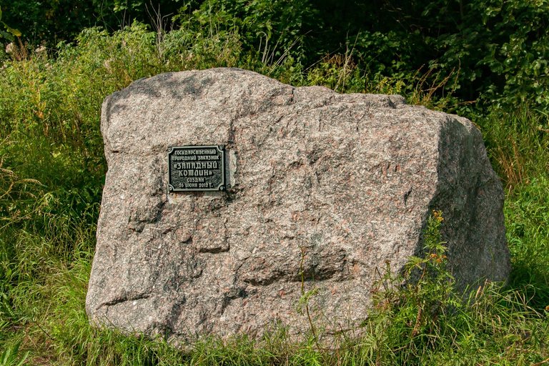
INFORMATION FROM THE NETWORK: "Zapadny Kotlin" is a nature reserve and concurrently one of the most popular routes for ecotourism in the vicinity of St. Petersburg. In February 2020, he entered the top five best places in Russia for bird watching. The trail route starts from the northern gate of Fort Schantz, winds along dirt paths, forest paths and sandy beaches of the reserve. The length of the section is one and a half kilometers.
To be honest, we did not enter the ecological path itself. Although there are a lot of birds there in August, they don't sing like in spring. Therefore, it was decided to move towards the far part of the island's coast.


The road was a well-trodden wide path, sprinkled with fine gravel. The nature around looked just fine, the wind from the bay brought coolness and neutralized the heat. There were practically no mosquitoes.

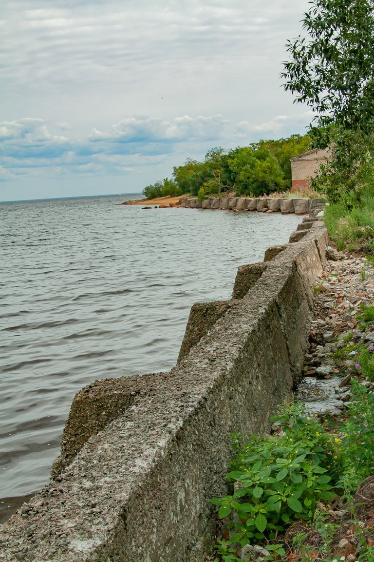
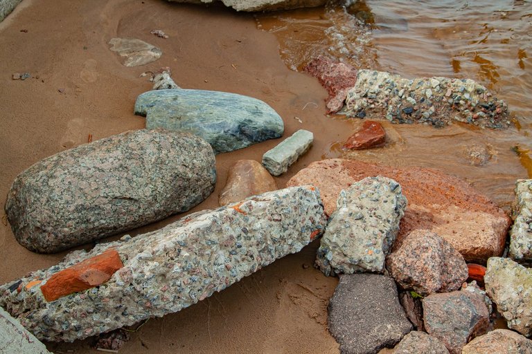
Several times we went off the road and came right to the shore. The local places are somewhat like a jungle, there are a lot of greenery and bushes, somewhat similar to mangroves. Along the edge of the shore, it was noticeable that the remains of ancient structures still represent a formidable defense of the island.

If I lived in St. Petersburg, I would often visit here. I just love all sorts of abandoned and forgotten ruins overgrown with moss and shrubs. My 16-year-old daughter surprisingly shares my hobbies and was ready to climb right in her heels into various wild places of the island.
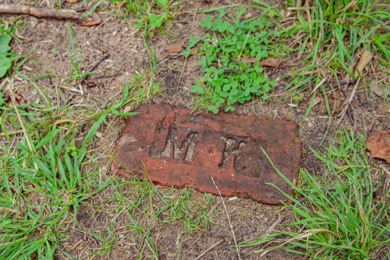
Several times we came across unusual finds - bricks of ancient masonry. I have a friend who passionately collects such things. But I wouldn't risk taking anything outside the reserve for him, because it's illegal.

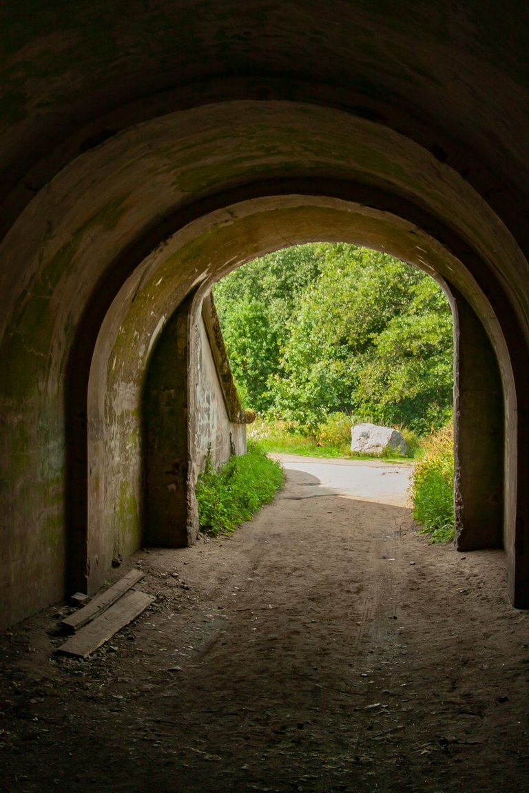
The outlines of the coastal zone are already visible ahead. We are moving along a road that for some reason is marked on the map as the Kronstadt highway. Along the way we find pillboxes and all sorts of coastal military fortifications. All of them are very ancient, some of them can be entered.
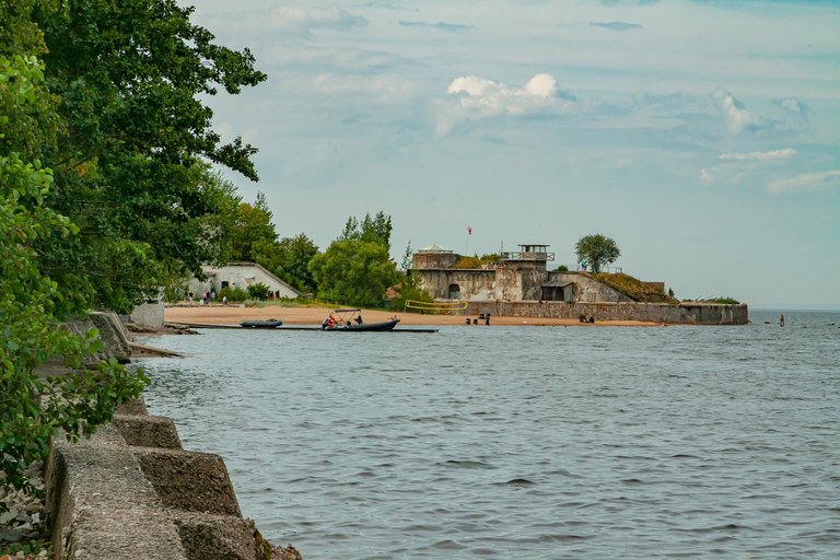
Tomorrow I will tell you in detail about the Reef Fort and show you a lot of photographs. Then there will be visits to museums, and of course, many, many concrete bunkers in the open air. And that's it for today!


Привет всем! Сегодня я продолжу свой рассказ о нашей семейной поездке в Кронштадт. Наш маршрут будет лежать в самую западную часть острова. Мы пройдём по территории природного птичьего заказника по направлению к форту "Риф".


СПРАВКА ИЗ СЕТИ: «Западный Котлин» — природный заказник и по совместительству один из популярных маршрутов для экотуризма в окрестностях Санкт-Петербурга. В феврале 2020 года вошёл в пятёрку лучших мест России для наблюдения за птицами. Маршрут тропы начинается от северных ворот форта Шанц, петляет по грунтовым дорожкам, лесным тропинкам и песчаным пляжам заказника. Продолжительность участка полтора километра.

Если честно, то на саму экологическую тропу мы не стали заходить. В августе там хоть и много птиц, но они не поют, как по весне. Поэтому было решено двигаться в сторону дальней части побережья острова.


Дорога представляла собой хорошо утоптанную широкую тропу, посыпанную мелким гравием. Природа вокруг выглядела просто прекрасно, ветер с залива приносил прохладу и нейтрализовал жару. Комаров практически не было.

Несколько раз мы сходили с дороги и подходили прямо к берегу. Здешние места чем-то напоминают джунгли, тут много зелени и кустов, чем-то похожих на мангровые заросли. По краю берега было заметно, что остатки старинных сооружений всё ещё представляют собой грозную защиту острова.


Если бы я жил в Петербурге, я бы часто бывал здесь. Я просто обожаю всякие заброшенные и всеми забытые развалины, поросшие мхом и кустарником. Моя 16-летняя дочь на удивление разделяет мои увлечения и готова была залезять прямо на каблуках в разные дикие места острова.

Несколько раз нам попадались необычные находки - кирпичи стариной кладки. У меня есть товарищь, который страстно коллекционирует подобные вещи. Но я бы не рискнул вывозить для него что-либо за пределы заповедника, ведь это незаконно.


Впереди уже видны очертания прибрежной зоны. Мы движемся по дороге, которая на карте почему-то обозначена, как Кронштадтское шоссе. По пути мы находим ДОТы и всякие прибрежные воинские укрепления. Все они очень древние, в некоторые можно войти.

Завтра я подробно расскажу о форте "Риф" и покажу множество фотоснимков. Далее будут посещение музеев, и конечно же, много-много бетонных бункеров под открытым небом. А на сегодня у меня всё!
Congratulations, your post has been added to Pinmapple! 🎉🥳🍍
Did you know you have your own profile map?
And every post has their own map too!
Want to have your post on the map too?