[ENG] Looking for a water fountain - Quebrada Gamboa / [ESP] En busca de una fuente de agua - Quebrada Gamboa
[ESP] En busca de una fuente de agua - Quebrada Gamboa
[ENG] Looking for a water fountain - Quebrada Gamboa
Buen día, hoy quiero compartir con ustedes otro de mis viajes en busca de una fuente de agua limpia que permita abastecer de agua a poblaciones aledañas al parque nacional El Ávila. Recientemente se publico una nota de prensa en el portal web Infobae titulada "Caracas, la ciudad sin agua corriente" donde el Director de la ONG Ojo Avizor, Norberto Baussón advirtió que la falla en el suministro afecta a casi 9 de cada 10 hogares venezolanos.. Esto me llevo a recordar las labores realizadas el año 2019 donde se nos solicito por parte del ejecutivo nacional, visitar 2 de las corrientes de agua que fluyen por el Parque Nacional el Ávila (Quebrada Gamboa y Quebrada Galindo) y la Quebrada Los Chorros en el Parque Nacional Los Chorros.
Good morning, today I want to share with you another of my trips in search of a clean water source that will allow to supply water to populations surrounding the National Park El Avila. A press release was recently published on the web portal Infobae entitled "Caracas, the city without running water" where Director of the NGO Ojo Avizor, Norberto Baussón warned that failure in supply affects nearly 9 out of 10 Venezuelan households.. This reminds me of the work carried out in 2019 where we are asked by the national executive, to visit 2 of the streams of water flowing through the National Park el Avila (Gamboa Creek and Galindo Creek) and the Creek Los Chorros in Los Chorros National Park.
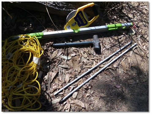
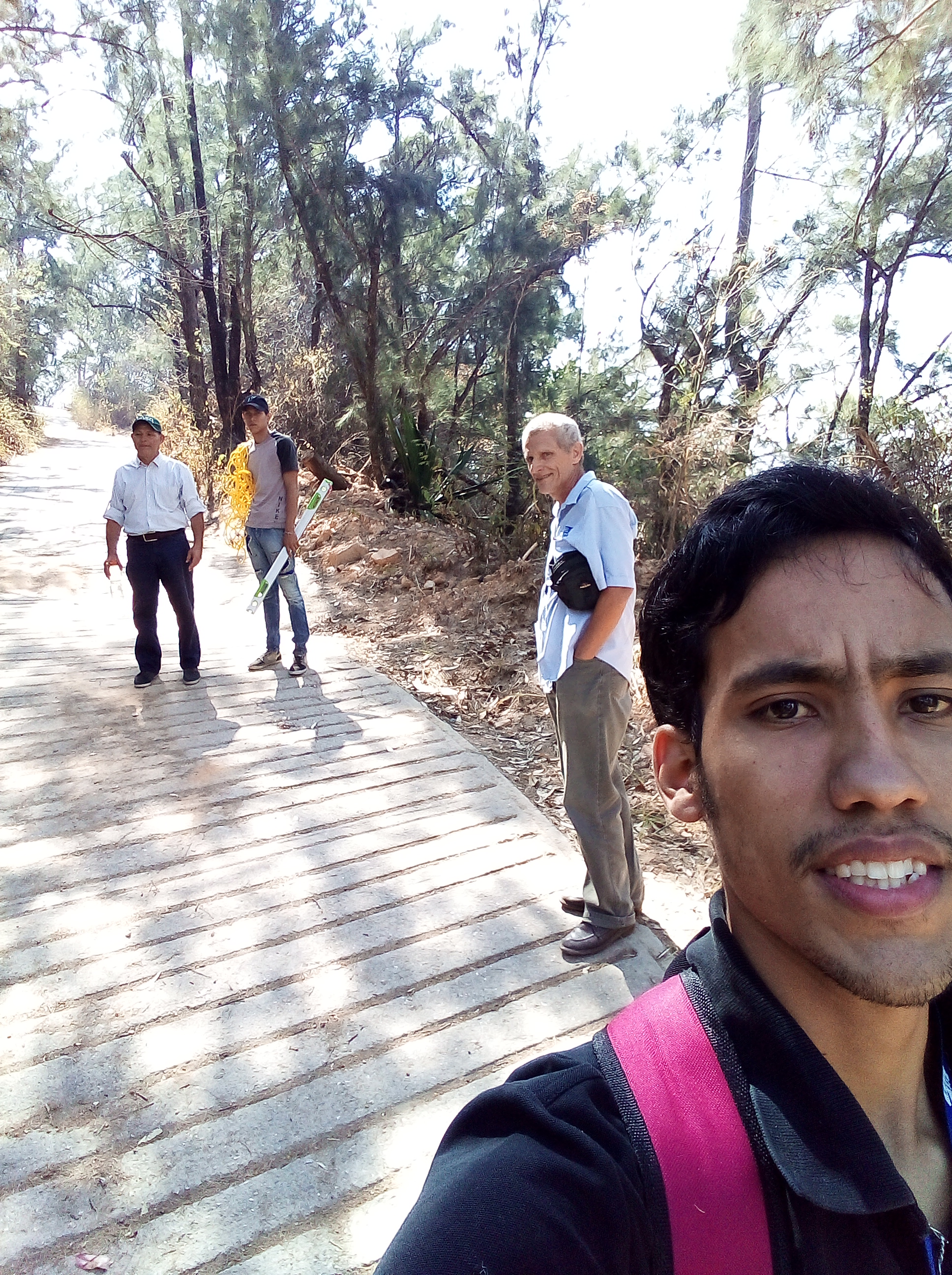
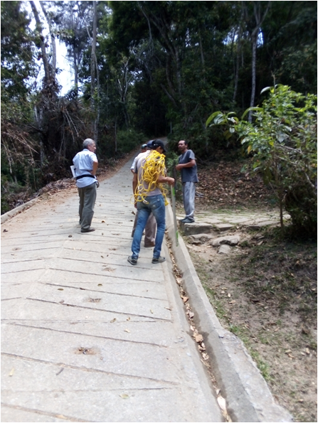
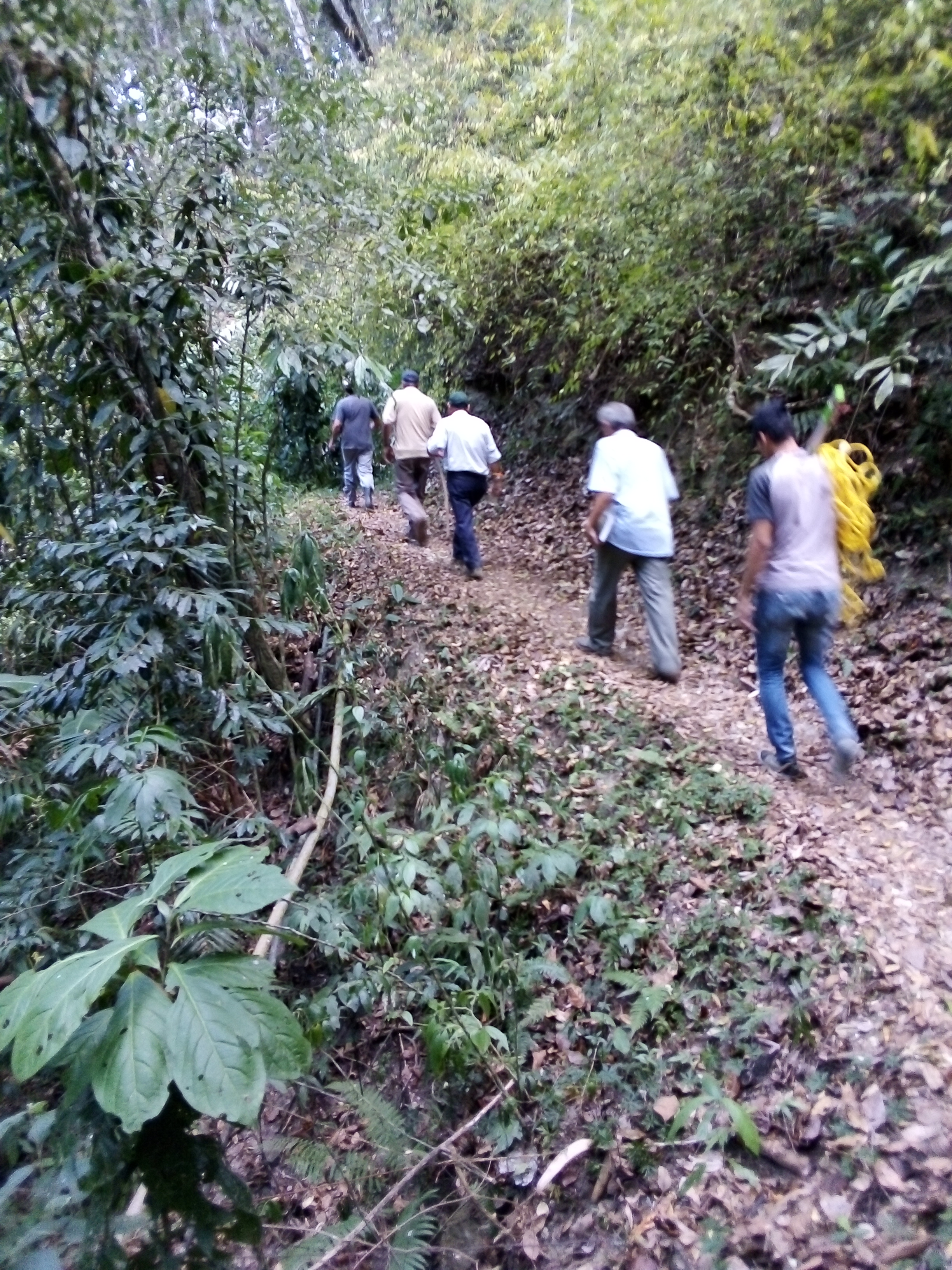
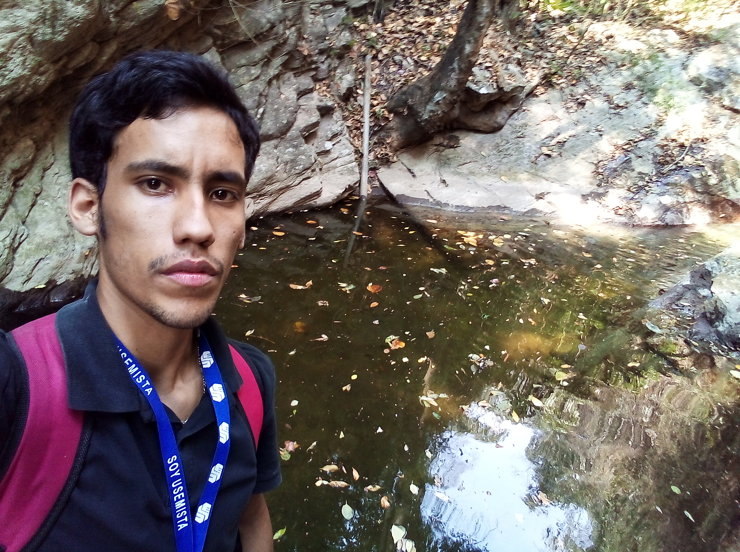
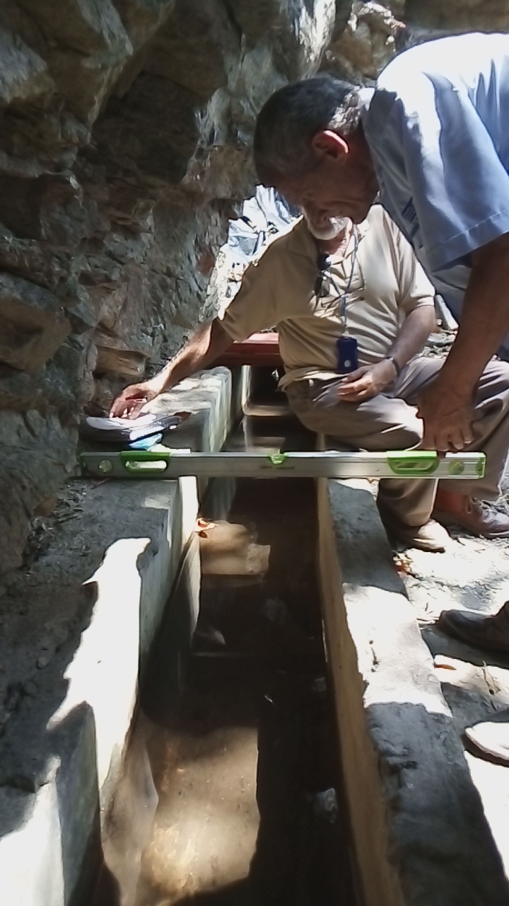
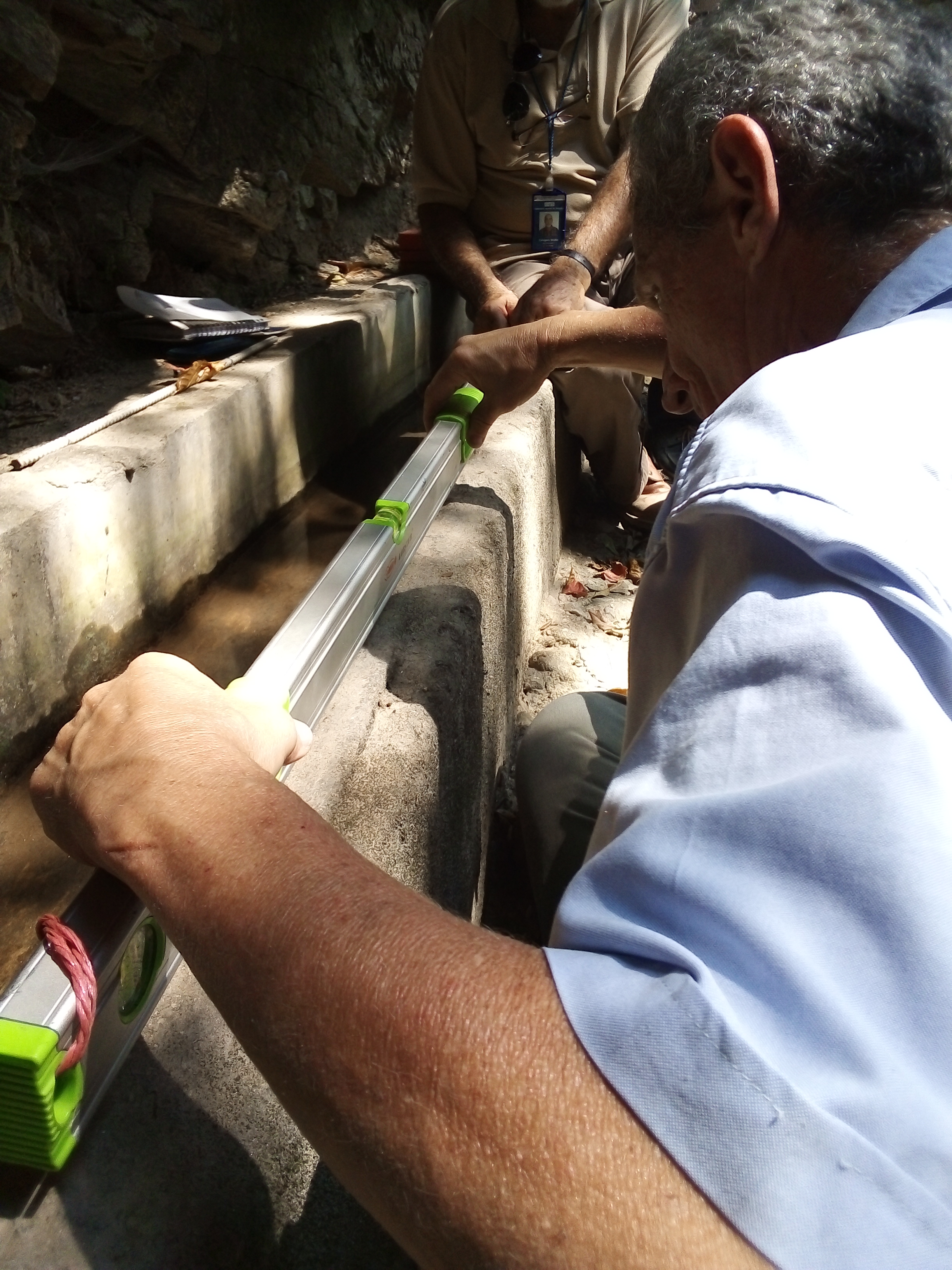
En esta oportunidad les hablare un poco de como fue el trabajo para localizar y medir el caudal de agua de la Quebrada Gamboa. Este trabajo lo lleve a cabo junto a 3 Ingenieros hidráulicos y un compañero que nos ayudo a cargar con las herramientas que usaríamos para medir el caudal una vez localizada la fuente de agua (Quebrada Gamboa). Creyendo que lo que conseguiríamos era una fuente abundante de agua, procedimos a llevar para la medición por el método de aforo volumétrico, dos barras metálicas, un martillo, una cinta métrica, un dispositivo GPS, una cuerda y un nivel de medición.
This time I'll tell you a little bit about how the job was to locate and measure the water flow of the Gamboa stream. This work is carried out together with 3 Hydraulic Engineers and a colleague who helped us load with the tools that we would use to measure the flow once the water source is located (Gamboa creek). Believing that what we would get was an abundant source of water, we proceeded to carry for measurement by the method of volumetric capacity, two metal bars, a hammer, a tape measure, a GPS device, a rope and a measurement level.
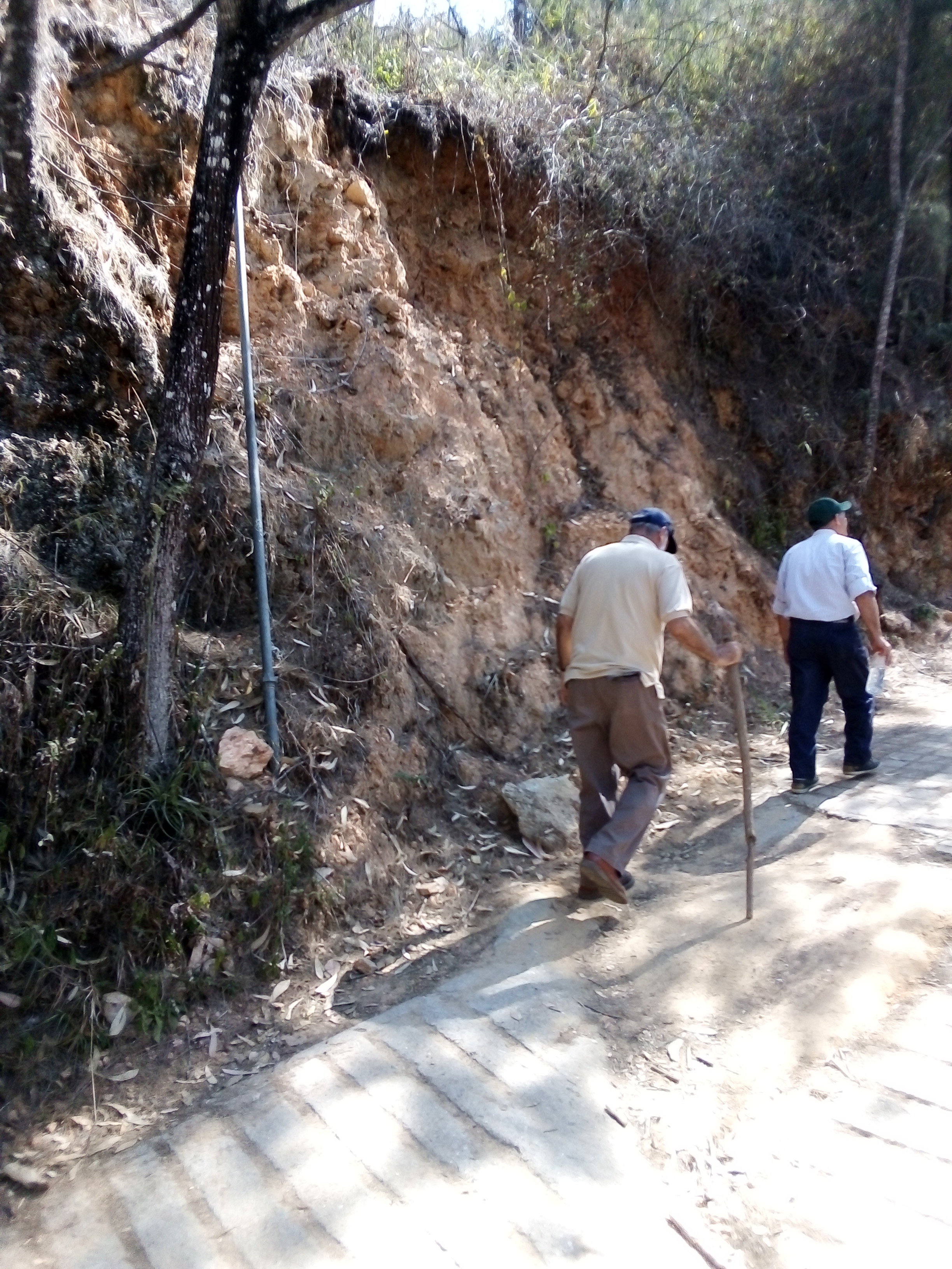
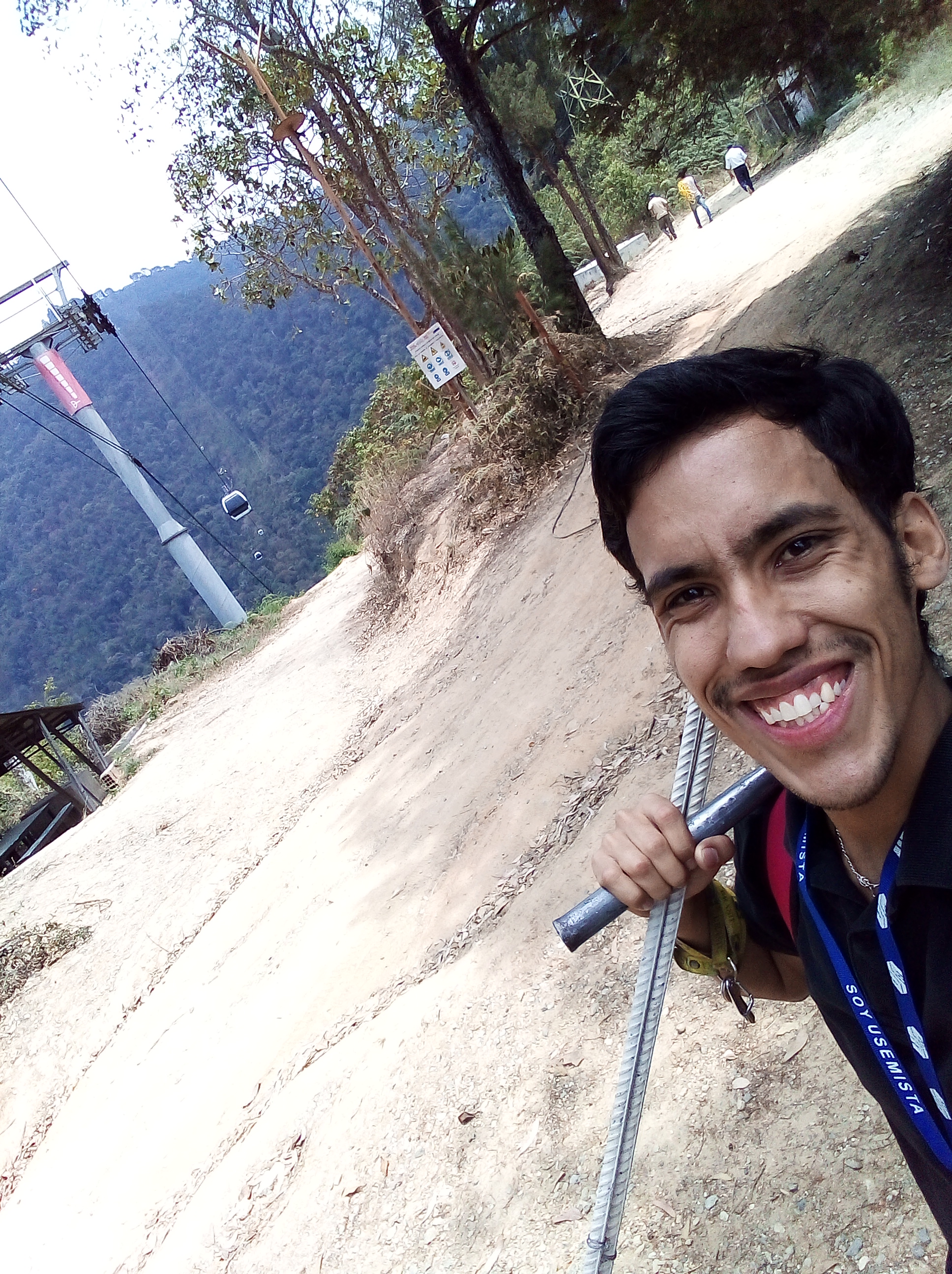
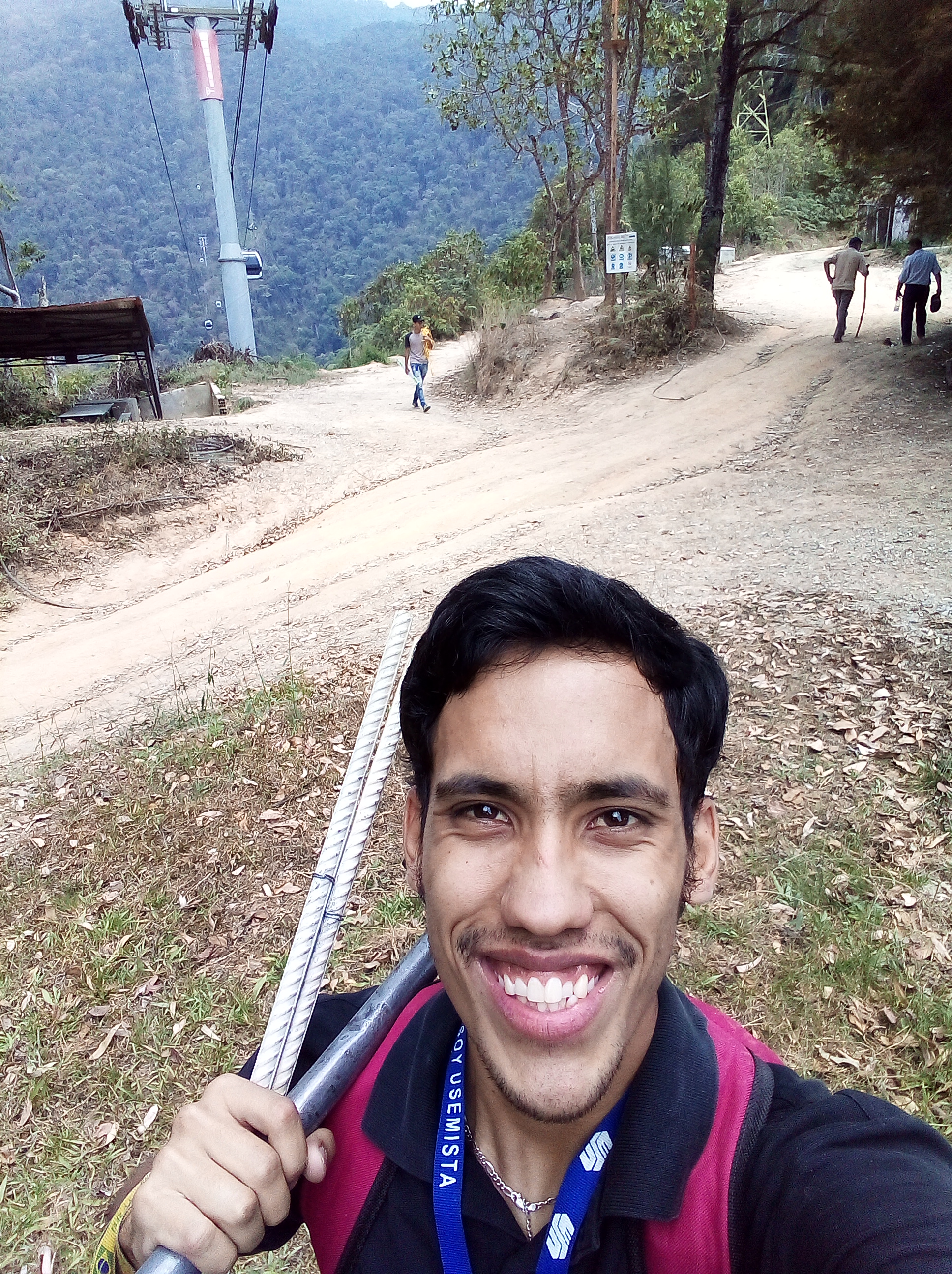
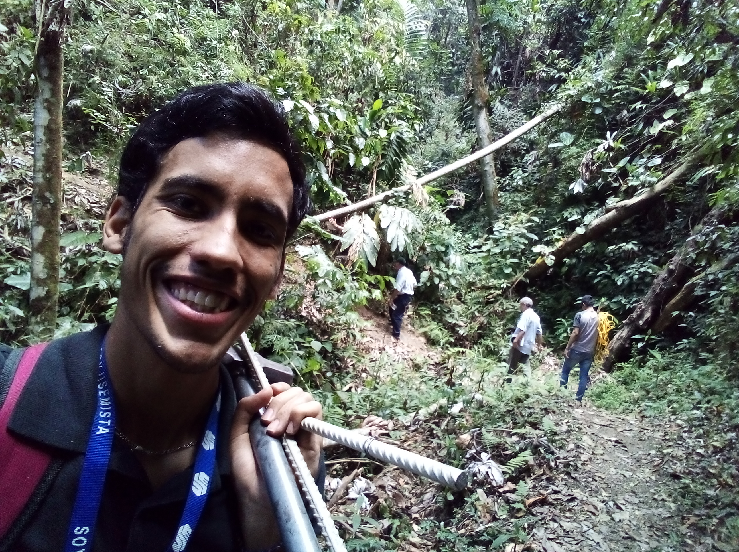
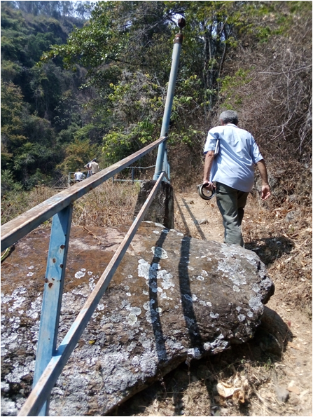
Comenzamos el acenso a pie del sendero a una altura inicial de 1030 metros sobre el nivel del mar (1030 m.s.n.m) por una ruta que cubre una parte con tramos de hormigón y su mayoría es de tierra, este sendero nos permitió pasar por debajo del sistema Teleférico el Ávila o también llamado el Teleférico Waraira Repano, que comunica a la ciudad de Caracas ( 1000 m.s.n.m ) con el pico El Ávila (2500 m.s.n.m).
We start the walking tour of the trail at an initial height of 1030 meters above sea level (1030 m.s.n.m) by a route that covers a part with stretches of concrete and most is of land, this trail allowed us to pass under the Cable Car system the Avila or also called the Waraira Repano Cable Car, which connects the city of Caracas ( 1000 m.s.n.m ) with the peak El Avila (2500 m.s.n.m).
Photograph @manuelmilano
Fotografía @manuelmilano
Photograph @manuelmilano
Fotografía @manuelmilano
Photograph @manuelmilano
Fotografía @manuelmilano
Photograph @manuelmilano
Fotografía @manuelmilano

Photograph @manuelmilano
Fotografía @manuelmilano

Photograph @manuelmilano
Fotografía @manuelmilano
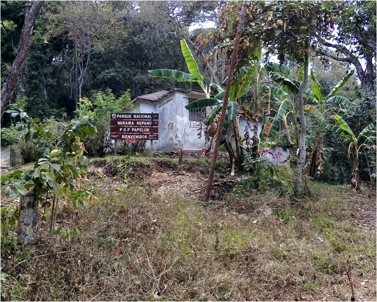
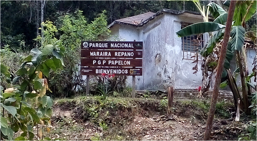
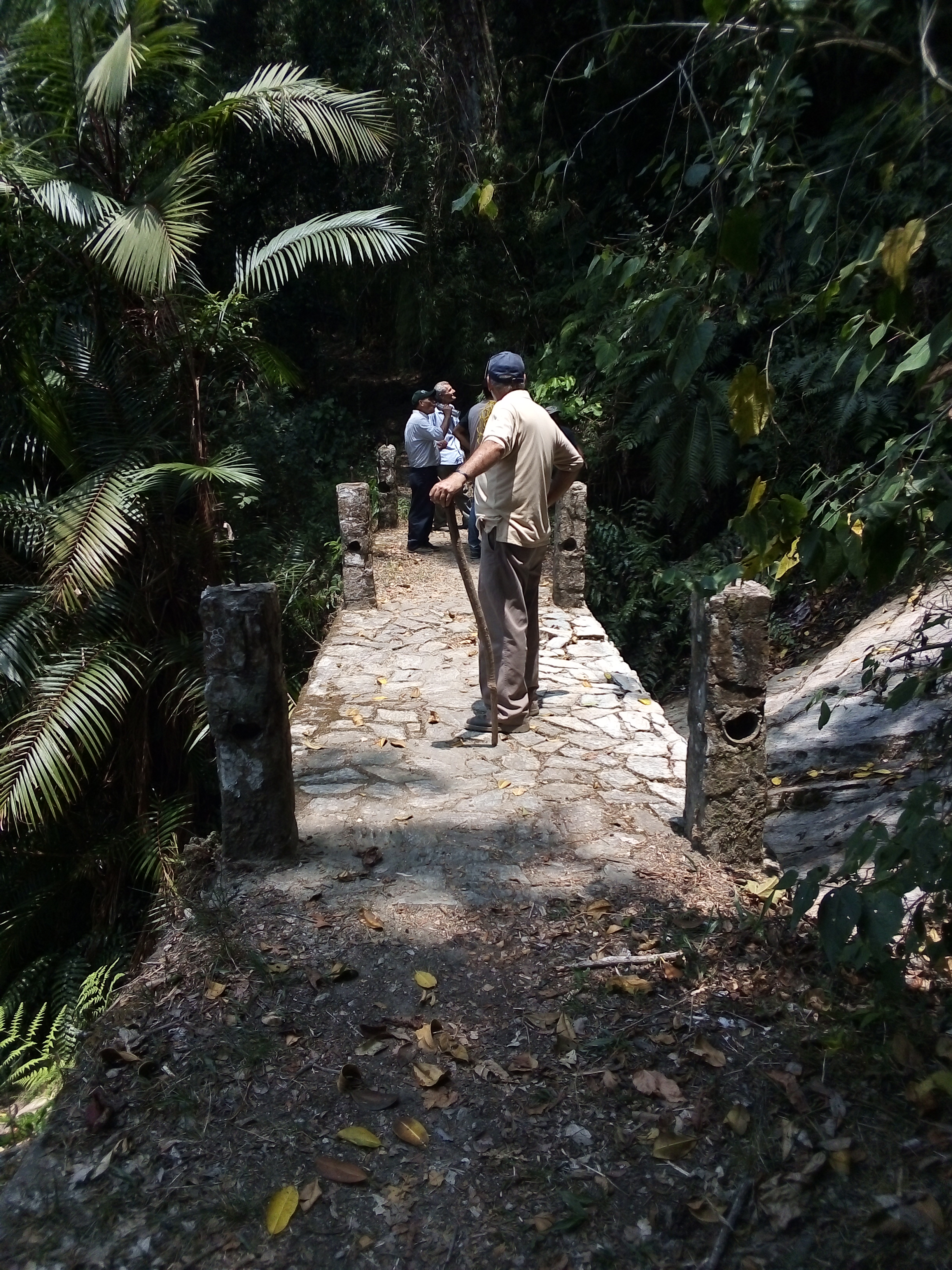
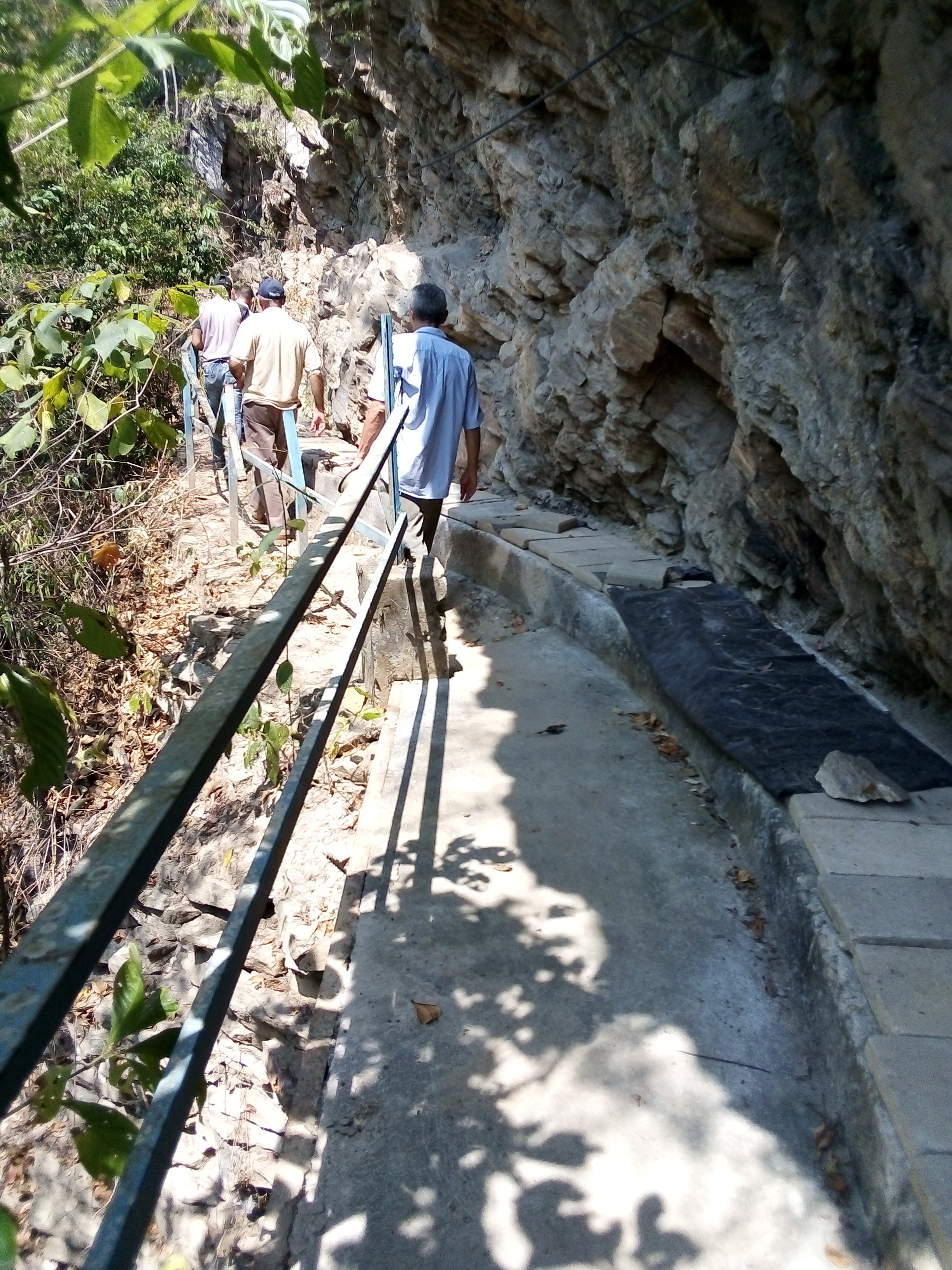
Cuando creíamos que ya no llegaríamos al punto de estudio (La Quebrada Gamboa) llegamos al puesto de guarda parques Papelón situado a una altura promedio de 1620 m.s.n.m. (Aproximadamente 4 km de recorrido). Una vez aquí, procedimos a conversar con el guarda parques que se encontraba cumpliendo sus labores en ese momento, donde le explicamos el motivo de nuestra visita, el cual con muchas ganas nos acompaño a la fuente de agua por la cual comenzó este viaje, La Quebrada Gamboa.
When we thought we would no longer reach the point of study (La Quebrada Gamboa) we arrived at the park guard post Papelón located at an average height of 1620 m.s.n.m. (Approximately 4 km of route). Once here, we proceeded to talk to the park guard who was doing his work at the time, where we explained the reason for our visit, which eagerly accompanied us to the water fountain (The Gamboa Creek).
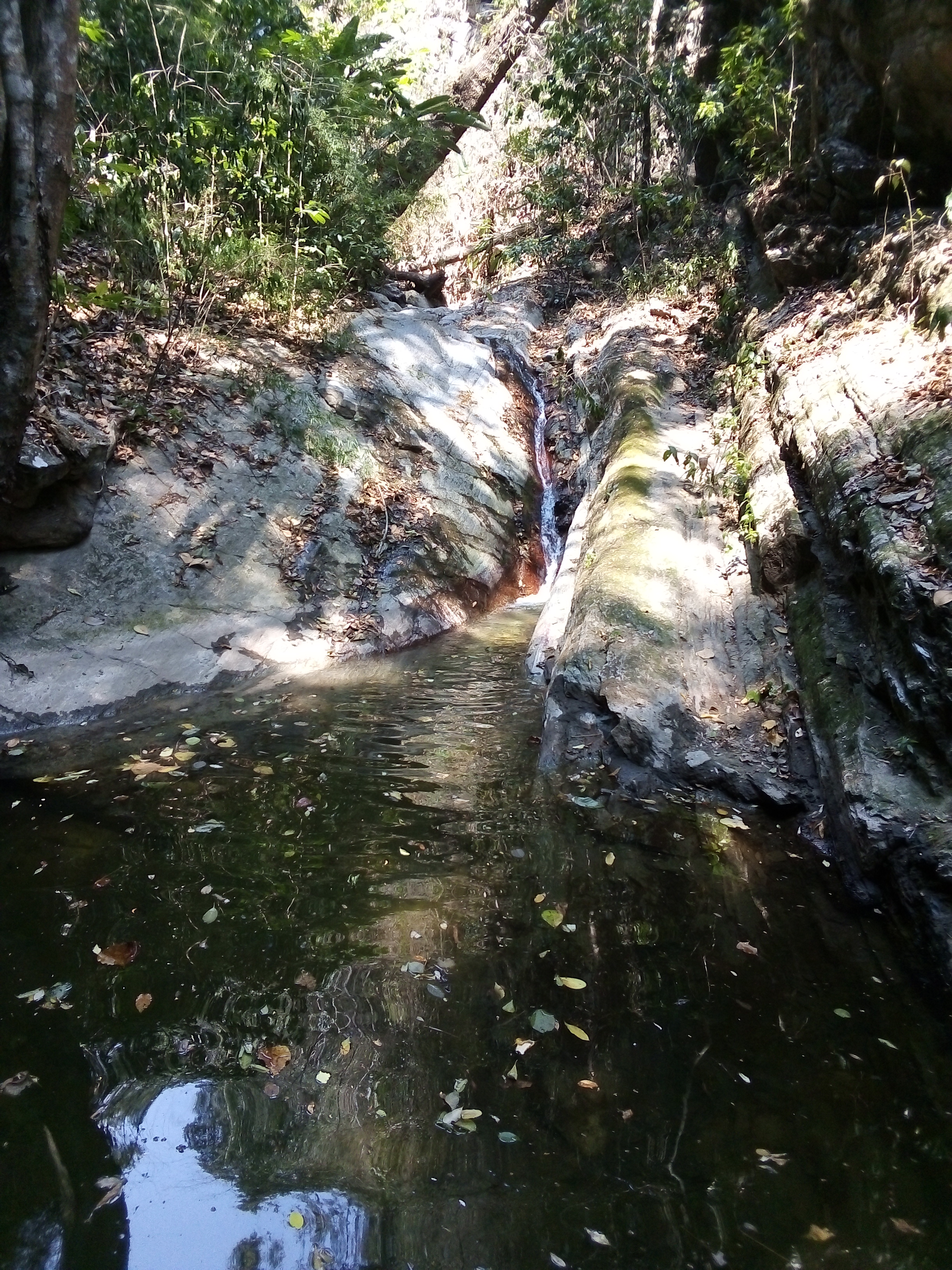
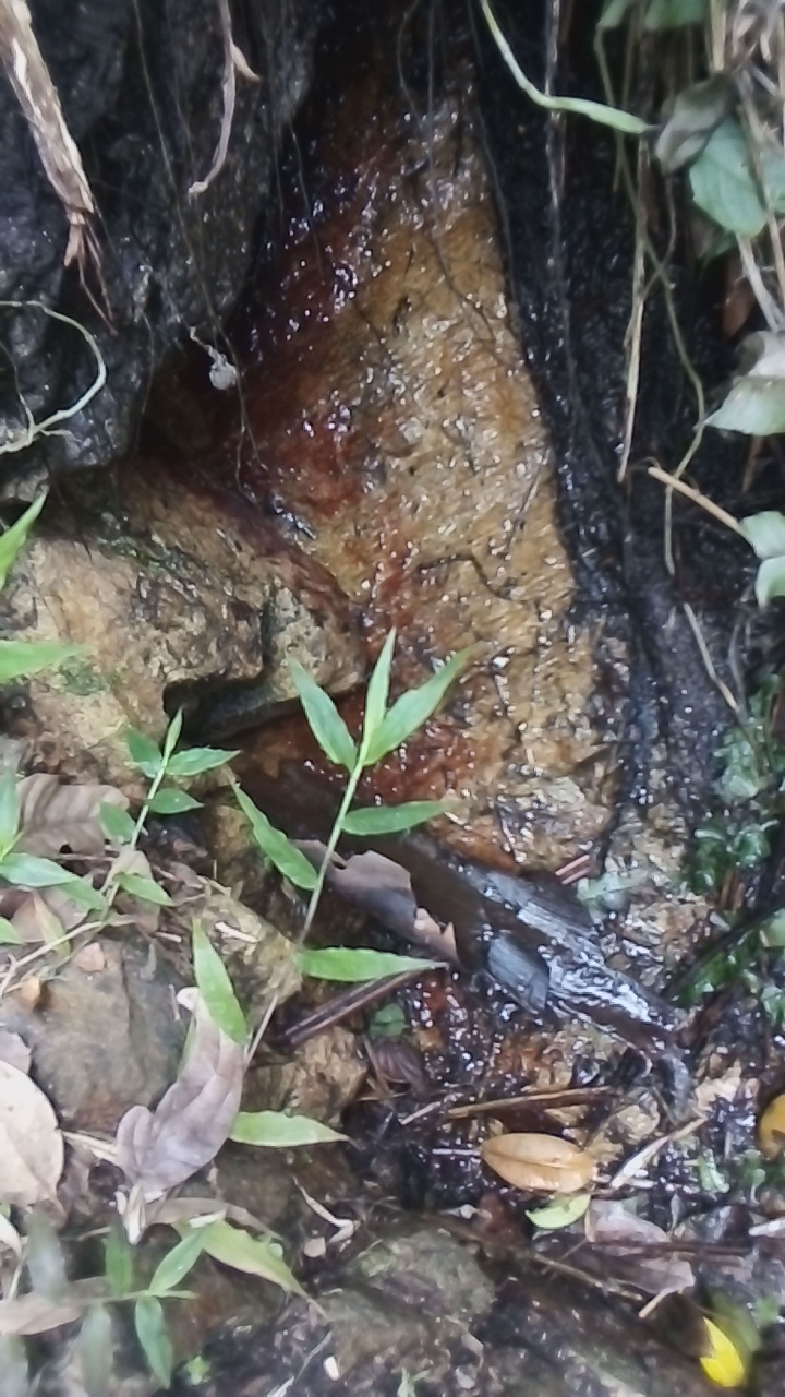
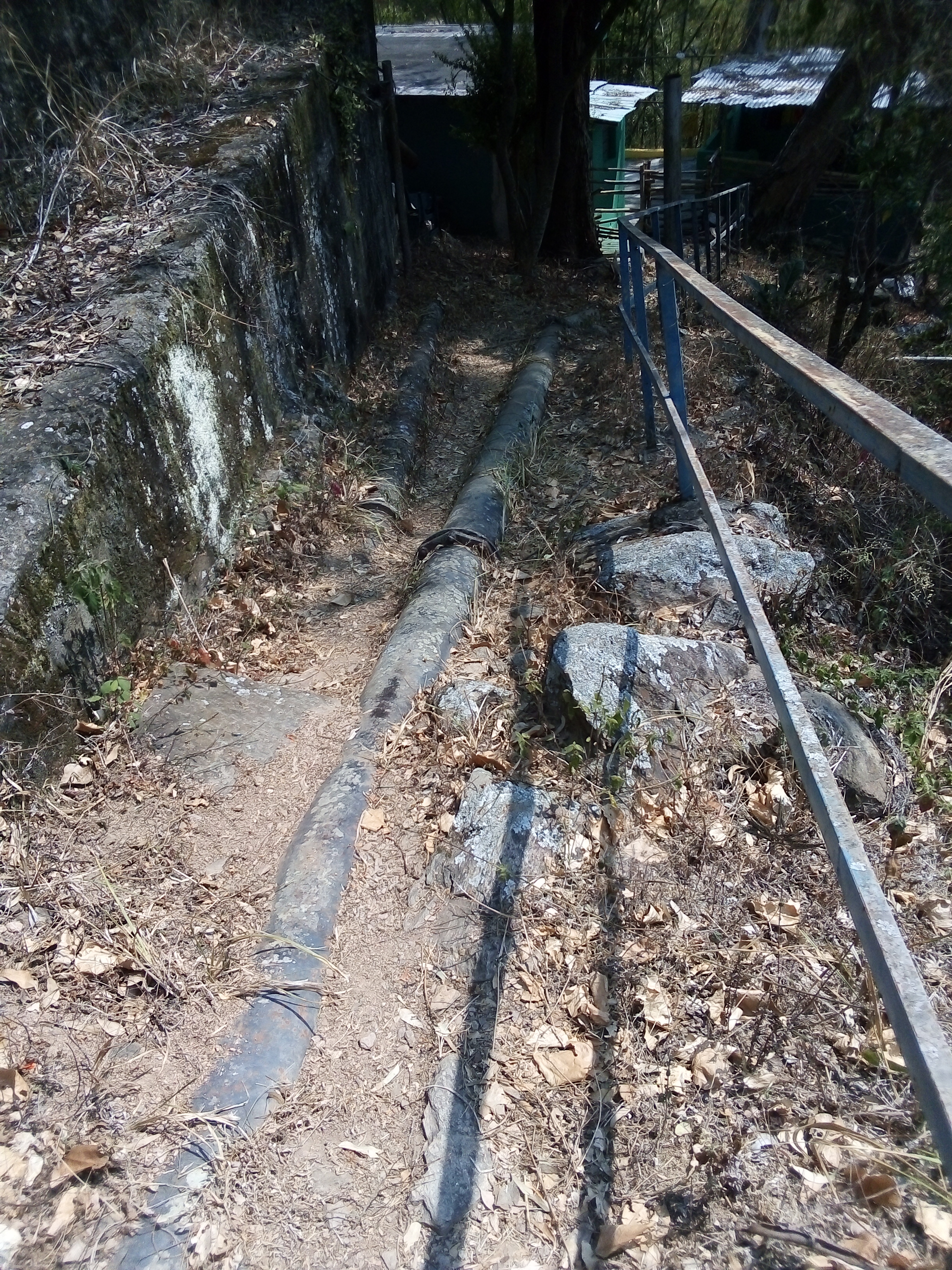
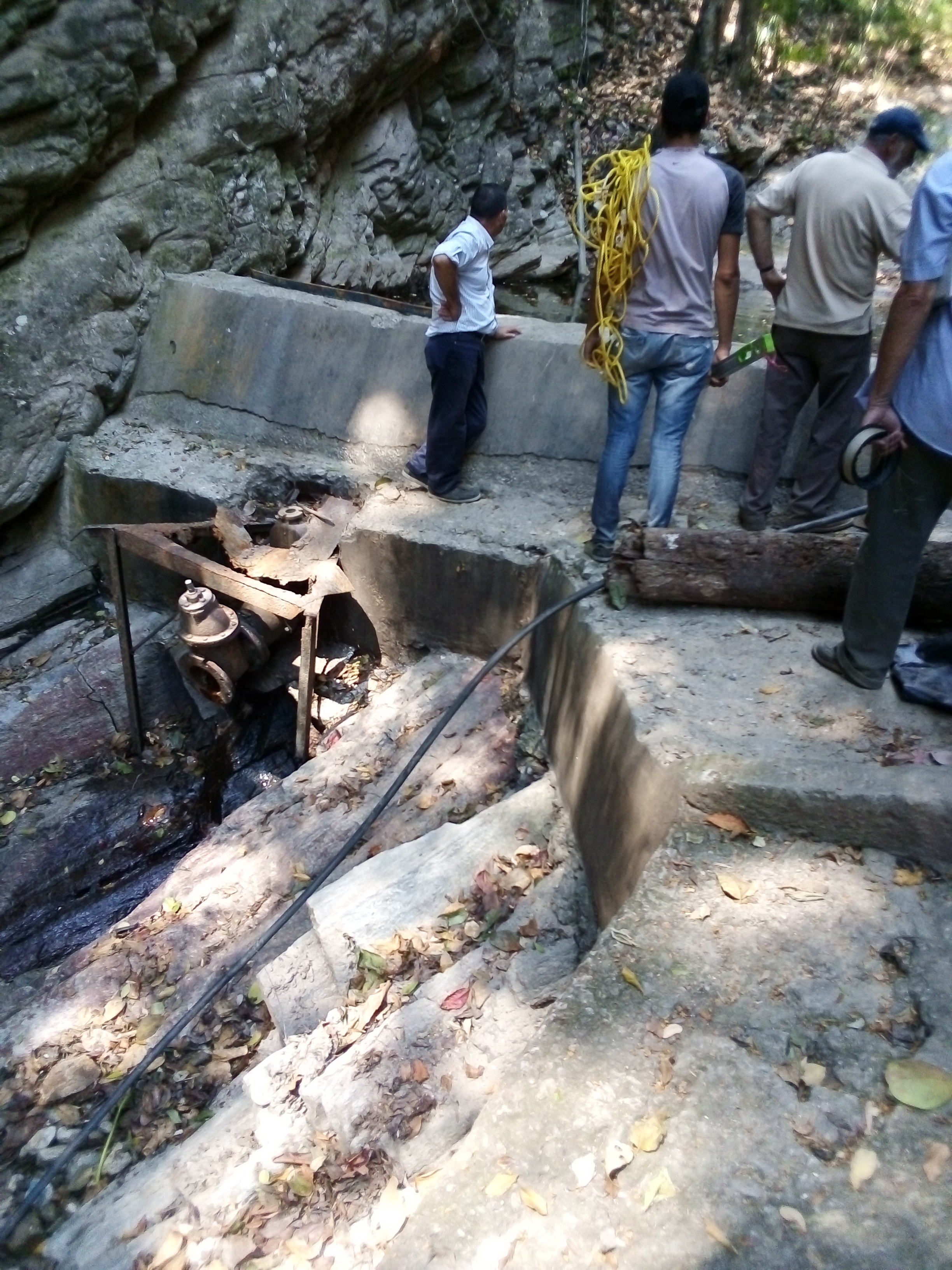
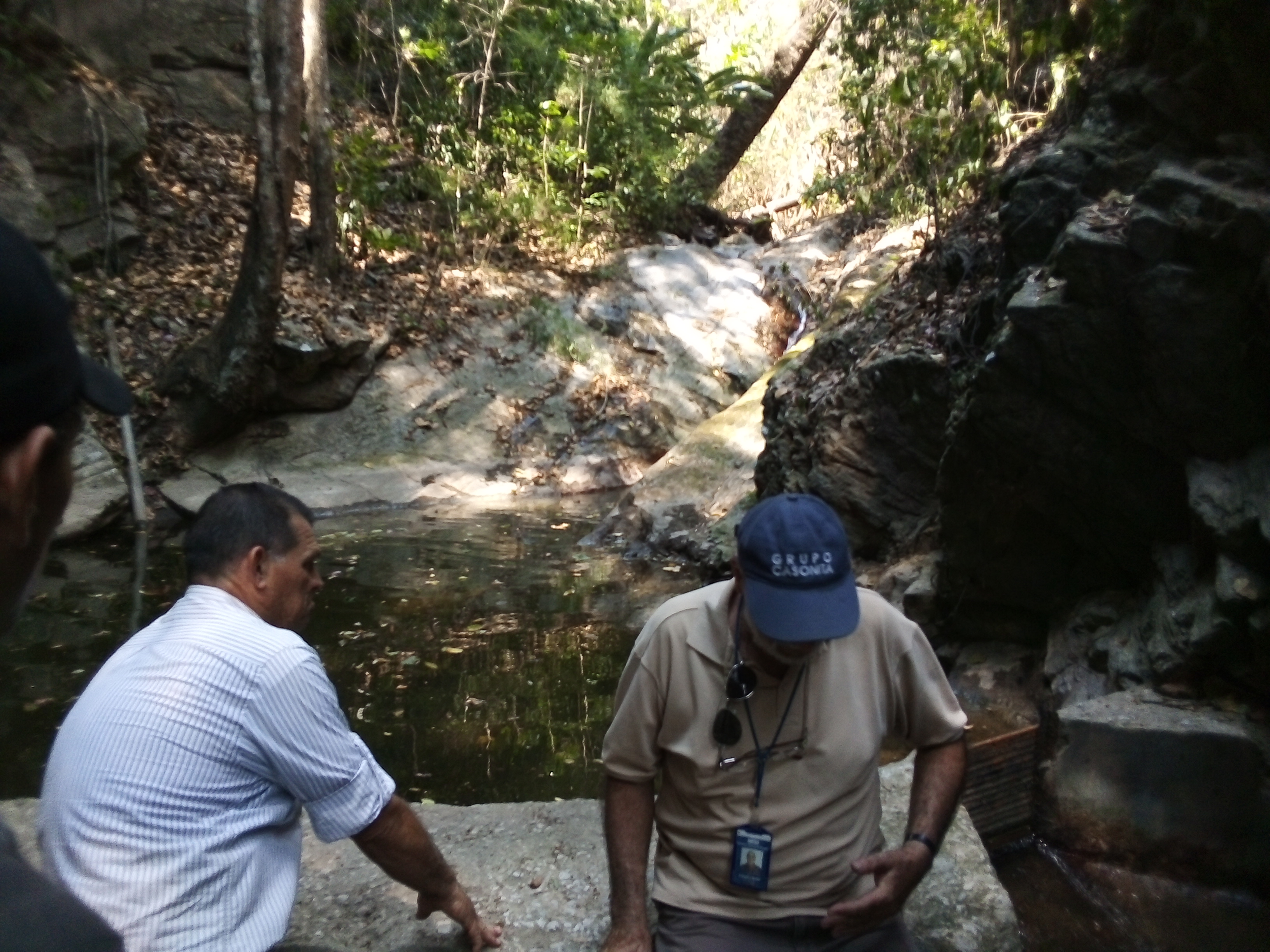
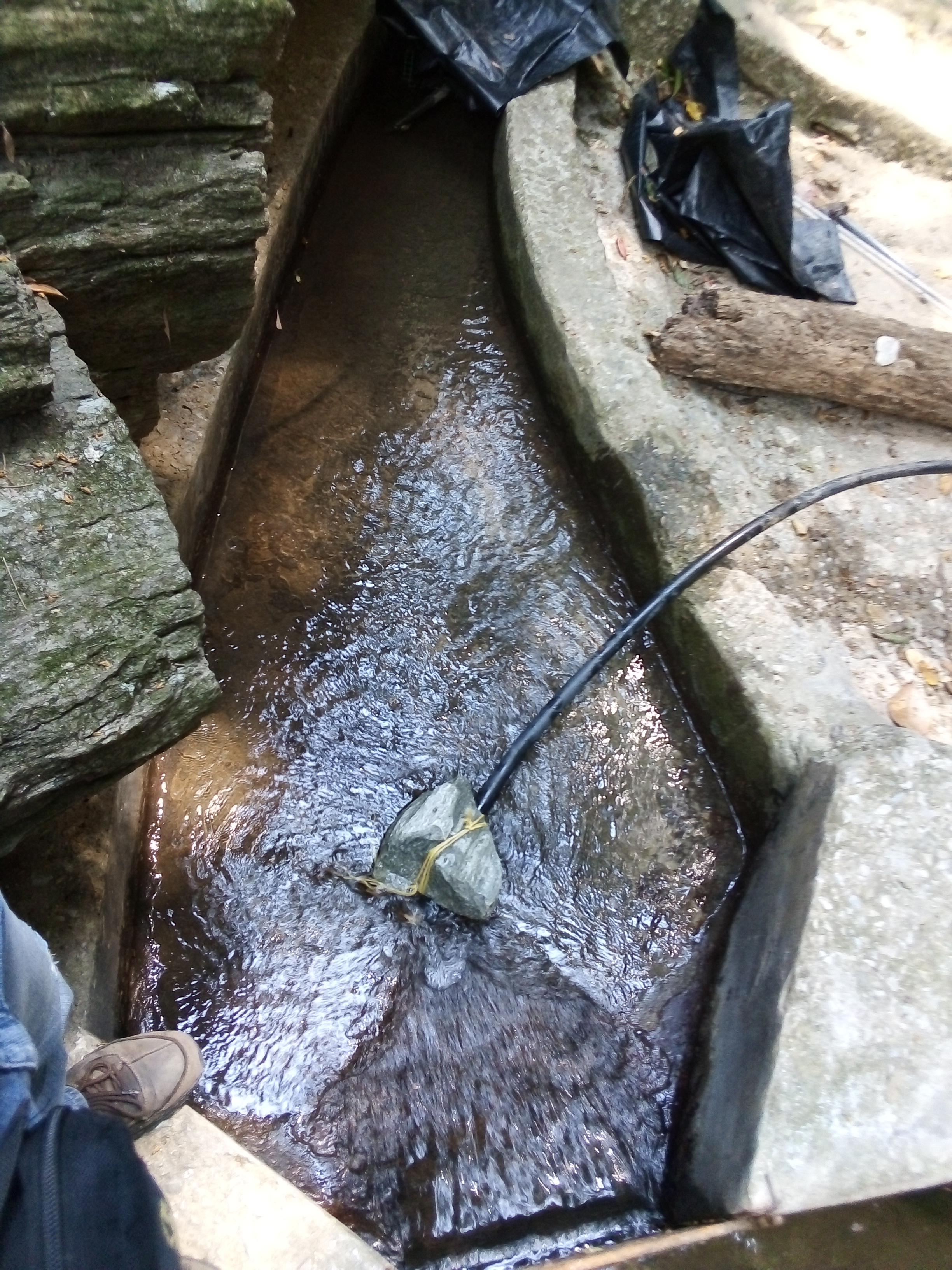
Al finalizar de explicar al guarda parques el porque estábamos ahí, nos acompaño por un sendero boscoso a la fuente de agua que estábamos buscando. Para nuestra sorpresa, nos encontramos una fuente de agua incipiente (no medible) por lo que no se pudo definir un caudal de agua en el sitio. Sin desanimarnos preguntamos al guarda parques, ¿dónde podríamos obtener una fuente de agua proveniente de la naciente que estábamos observando? el guarda parque respondió, que al inicio del recorrido que habíamos realizado se encontraba un dique de agua, este retenía los afluentes de agua provenientes de la naciente de agua a estudiar. Este dique permite abastecer de agua a los camiones cisternas usados para las distribución del agua a la población.
At the end of explaining to the park guard why we were there, he accompanied us down a wooded path to the water fountain we were looking for. To our surprise, we found an incipient (non-measurable) water source so a water flow could not be defined at the site. Without discouraging us to ask the park guard, where could we get a source of water from the nascent we were observing? the park guard replied, that at the beginning of the tour we had made was a water dam, it retained the tributaries of water from the water nascent to be studied. This dam allows to supply water to the tanker trucks used for the distribution of water to the population.
Photograph @manuelmilano
Fotografía @manuelmilano
Photograph @manuelmilano
Fotografía @manuelmilano
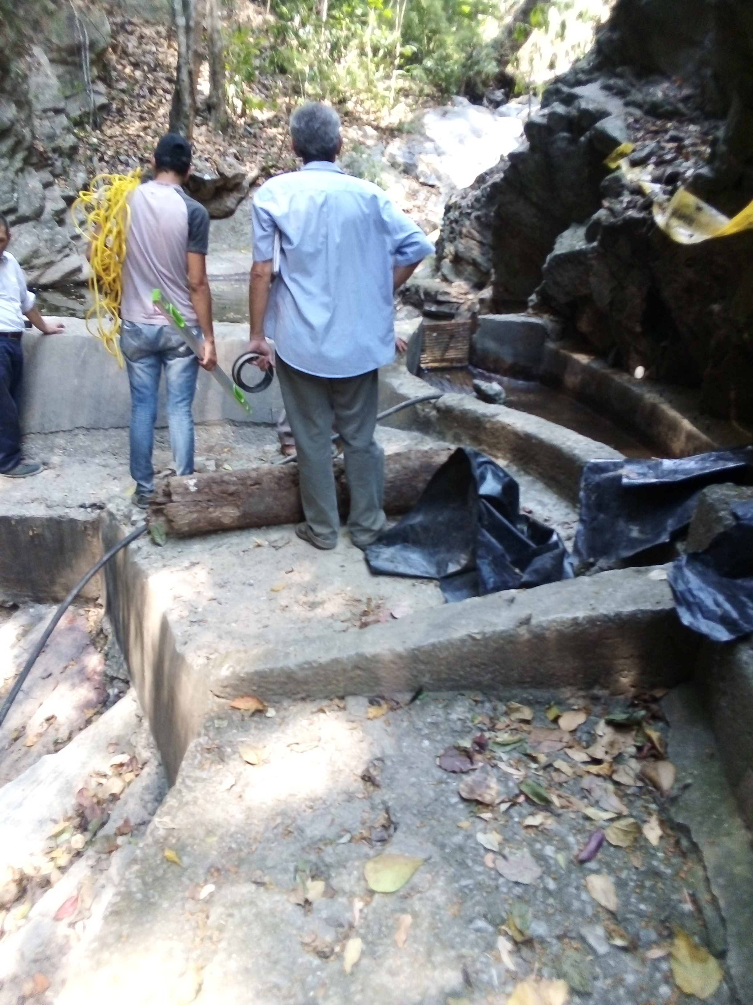
Para finalizar esta publicación, no compartiré el descenso realizado para llegar a el dique Gamboa, esto porque es el mismo recorrido realizado. A continuación, les comparto la memoria fotográfica del proceso de medición de caudal de agua realizado una vez que llegamos al sitio. 👇 👇 👇 👇
To finish this post, I will not share the descent made to reach the Gamboa dam, this is because it is the same tour made. I share the photographic memory of the water flow measurement process performed once we arrive at the site. 👇 👇 👇 👇
Photograph @manuelmilano
Fotografía @manuelmilano
Photograph @manuelmilano
Fotografía @manuelmilano
Photograph @manuelmilano
Fotografía @manuelmilano
Photograph @manuelmilano
Fotografía @manuelmilano
Photograph @manuelmilano
Fotografía @manuelmilano
Photograph @manuelmilano
Fotografía @manuelmilano
Photograph @manuelmilano
Fotografía @manuelmilano
Photograph @manuelmilano
Fotografía @manuelmilano
Photograph @manuelmilano
Fotografía @manuelmilano
Photograph @manuelmilano
Fotografía @manuelmilano
Photograph @manuelmilano
Fotografía @manuelmilano
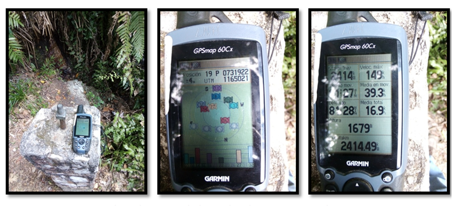
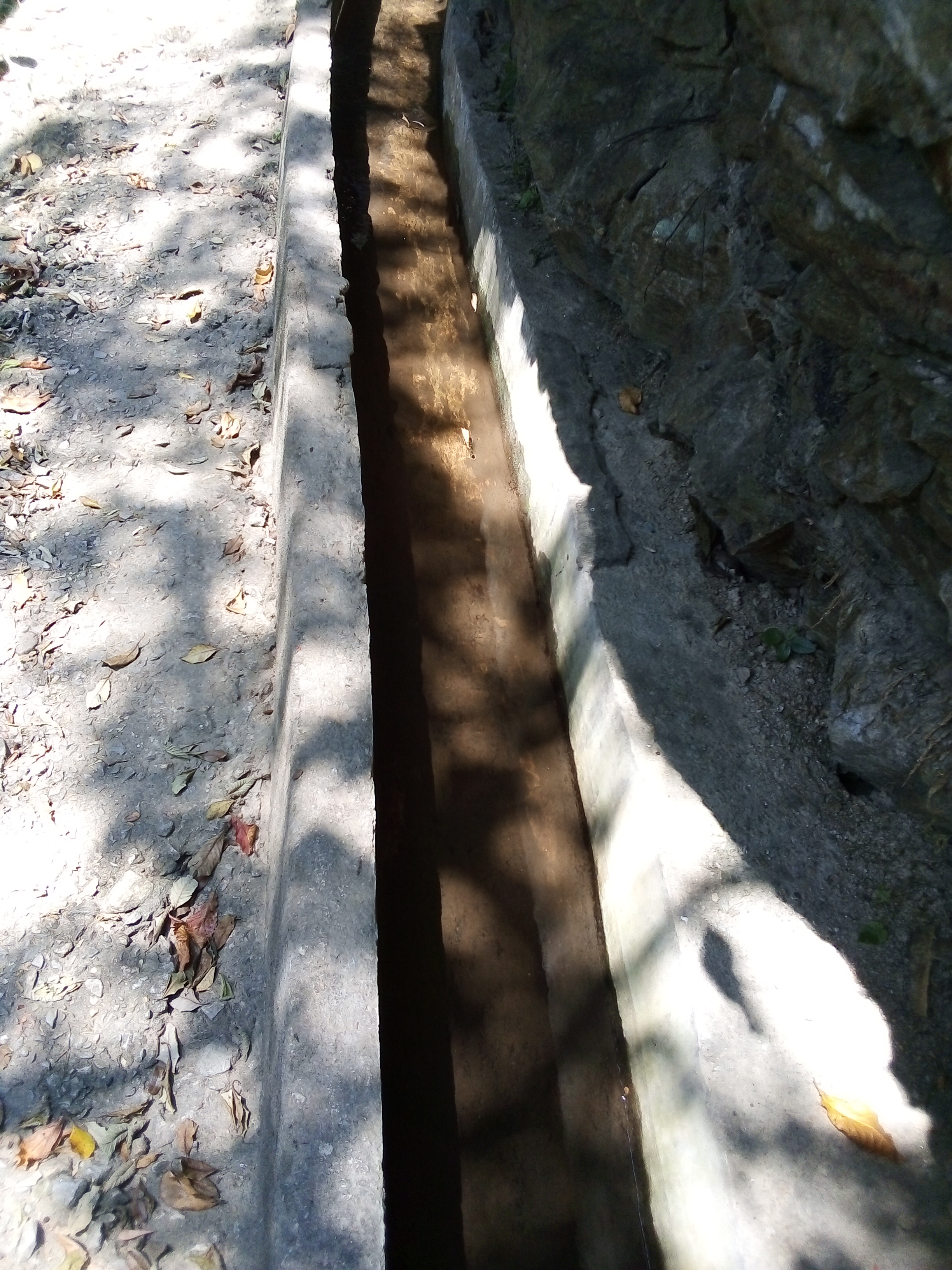
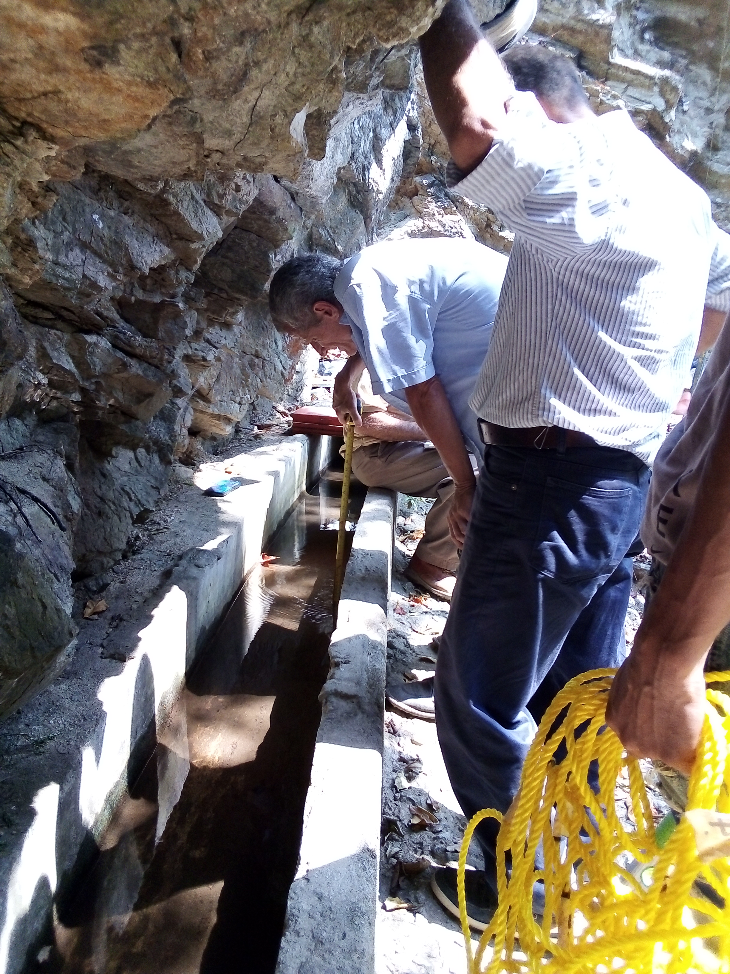
El canal posee un ancho de 37,5 cm y alto 31 cm, con espesor de columna de agua de 3,9 cm. Se realizó la medición del caudal determinando que es 2,5 l/s. Este caudal es usado para alimentar un tanque de 216 m3, con esto se pueden abastecer tan solo 16 camiones cisternas de 10000 litros c/u (16000 l/dia).
The channel has a width of 37.5 cm and height 31 cm, with water column thickness of 3.9 cm. The flow measurement was performed determining that it is 2.5 l/s. This flow rate is used to feed a tank of 216 m3, this can supply only 16 tankers of 10000 liters c/u (16000 l/day).

Voted on behalf of the Neoxian city paper curation team. Thanks for sharing with us the information along with pictures.
Posted via neoxian.city | The City of Neoxian
[ENG]
@sayee Thank you to your team for supporting this post and congratulations on helping other users grow on this wonderful Social Network. HAPPY DAY.
[ESP]
@sayee Gracias a su equipo, por apoyar está publicación y felicidades por ayudar a otros usuarios a crecer en esta maravillosa Red Social. FELIZ DÍA.
Congratulations @manuelmilano! You have completed the following achievement on the Hive blockchain and have been rewarded with new badge(s) :
Your next target is to reach 3750 upvotes.
You can view your badges on your board and compare yourself to others in the Ranking
If you no longer want to receive notifications, reply to this comment with the word
STOPCheck out the last post from @hivebuzz:
Impressive article! With much attention to detail, you have clearly shown us the meticulous process of your journey in searching for a natural water supply source. Are there times during the year that the water fountain stops producing its resource? If so, what's the worst thing that could happen @manuelmilano?
[ENG]
Good morning, @storiesoferne. Thank you again for your support in this new post. To answer your question, In Venezuela we have only two seasons a year, the dry season (December - April) and the rainy season that runs from the end of April to the month of November. During the dry season these surface water sources do not have optimal flow rates and even tend to dry completely affect even more the common problem that the City of Caracas lives due to lack of water resource.
Today in the city of Caracas and throughout the country, we are under constant water rationing, this is due to the constant failures that exist in the operation of the water production, transport and distribution system due to lack of maintenance in mechanical equipment and in the pipes of the network. In addition, planned works to offset water demand due to population growth have not been completed.
[ESP]
Buen día @storiesoferne. Gracias nuevamente por su apoyo en esta nueva publicación. Para dar respuesta a su pregunta, En Venezuela tenemos solo dos estaciones al año, la estación seca (Diciembre - Abril) y la temporada de lluvias que va desde finales de Abril hasta el mes de Noviembre. Durante la temporada seca estas fuentes de agua superficiales no cuentan con caudales óptimos e incluso suelen secarse por completo afectando aun más al problema frecuente que vive la Ciudad de Caracas por falta de el recurso hídrico.
Hoy en la ciudad de Caracas y en todo el país, estamos bajo un racionamiento de agua constante, esto se debe a las constantes fallas que existen en la operatividad del sistema de producción, transporte y distribución de agua por falta de mantenimiento en los equipos mecánicos y en las tuberías de la red. Además, no se han finalizado las obras planificadas para compensar la demanda de agua por el incremento de la población.
Okay, I understand. That makes your work critically crucial for the continuous development of your community in terms of its valuable water supply. Many thanks for the personal sacrifices and dedicated services that you and your engineering team have contributed to the ultimate progress of your region! More blessings!
[ENG]
Thanks
[ESP]
GRACIAS.
Buen trabajo mi hermano sé cuánto sufren los Caraqueños por el vital líquido. Viví alla 7 años y la mala calidad de vida por causa de entre otras cosas, la falta de agua es terrible.
Anhelo que tu trabajo y el de tus compañeros profesionales sea de gran utilidad para lograr solventar esas necesidades básicas de mi Venezuela bella. Bendiciones para ti
[ESP]
Buen día @graceleon, gracias por su comentario. Hoy en día la gran mayoría de los venezolanos tienen una rutina diaria una vez que llega el agua, lo primero que se hace es llenar los tanques y botellones, ya que aveces solo dura pocas horas el suministro. Luego se procede con la limpieza general de la vivienda (bañarse, fregar, limpiar y lavar). En algunas zonas urbanas y rurales del país, no cuentan con el agua por tubería, obligando a las comunidades a pagar más por el vital liquido y recurrir a sistemas de abastecimiento informales (hace filas con su tobo para surtirse de un camión cisterna, un manantial o incluso hacer tomas de agua ilegales de tuberías de zonas vecinas).
Cuando veo y sé de éstas cosas que ustedes sufren mi alma se quiebra en llanto y dolor, no puedo entender por que mi pueblo sufre tanto.
Yo aqui en Buenos Aires tengo agua por montón y veo como se desperdicia en las calles....es todo un tema porque lo que nos sobra acá a ustedes les salvaría la vida pero éstas son las cosas que no se entienden de la vida.
Dios te dé mucha sabiduría para aportar soluciones factibles y que mi pueblo venezolano no sufra más por agua.
Tremendo post mi hermano
[ESP]
GRACIAS nuevamente por tus emotivas palabras. El agua es algo que sobra en nuestro país, pero el mal manejo del recurso hídrico, la falta de personal calificado y el deterioro constante de la infraestructura hídrica (falta de inversión gubernamental) tiene a nuestro país (Venezuela) inmerso en una crisis nacional en temas de abastecimiento de agua potable y su saneamiento.
Unique, I never saw this many details about collecting natural water from the source. So, this waterfall always stays like this? I mean during summer, does it give enough water?
[ENG]
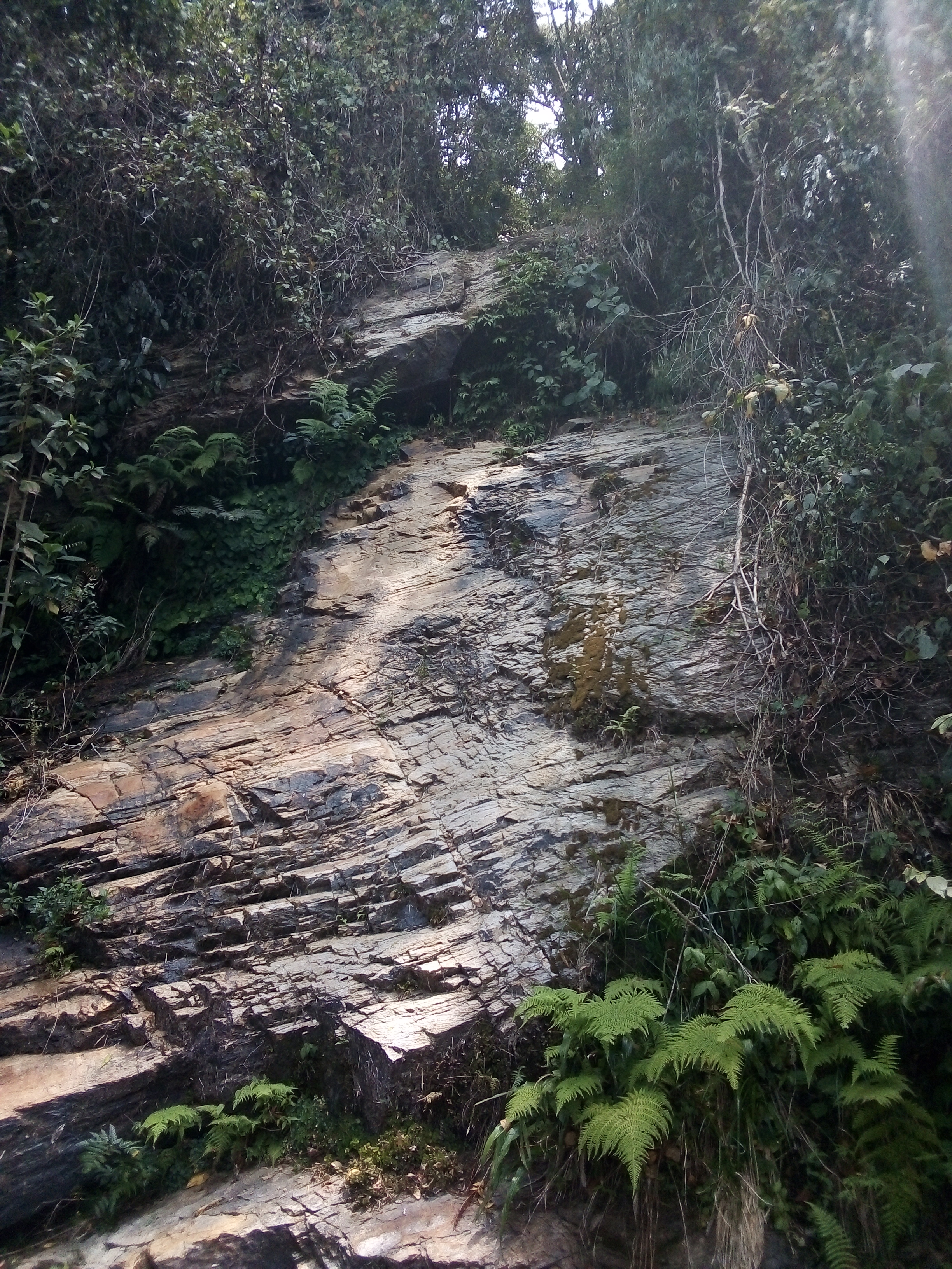
Good morning @priyanarc, thank you for your comment, regarding your question, in dry seasons the waterfall displayed in the video is completely dry (can be seen in the photograph where you see the rock wall without water.
[ESP]
Buen día @priyanarc, gracias por tu comentario, respecto a tu pregunta, en temporadas seca la cascada visualizada en el vídeo queda totalmente seca (se puede apreciar en la fotografía donde se ve la pared de roca sin agua.
Interesting...
[ENG]
Good morning @priyanarc, thank you for your comment, regarding your question, in dry seasons the waterfall displayed in the video is completely dry (can be seen in the photograph where you see the rock wall without water.
[ESP]
Buen día @priyanarc, gracias por tu comentario, respecto a tu pregunta, en temporadas seca la cascada visualizada en el vídeo queda totalmente seca (se puede apreciar en la fotografía donde se ve la pared de roca sin agua.
Very nice
[ENG]
Good morning @prakshsingh - Thank you for your comment. -
Good morning wlc
Great article and photos!
[ENG]
Thanks 👍
Excellent work @manuelmilano! It's a challenging task but it seems you're enjoying your job very much from reading your experiences and the smile on your face during the treks and water explorations and testing. Which is your favorite part of the entire process?
[ENG]
Good morning, thank you for supporting me in this new publication. Now, as you said yourself, I always enjoy hiking, and the more impine the route is in search of a water supply solution for the populations that need it, the better.
What I like the most about this is to be able to meet the proposed objective (to provide a solution to the scarcity of water resources) and of course, to be able to overcome the terrain we face.
Note: The volumetric gauging method varies based on the water source to be measured.
I want to admit, that just like me, the engineers who accompany me, despite their advanced age, enjoy these routes and reach the points that they want to evaluate.
[ESP]
Buen día, gracias por apoyarme en esta nueva publicación. Ahora bien, como usted misma lo a dicho, siempre disfruto estás caminatas, y mientras más impinado sea el recorrido en busca de una solución de abastecimiento de agua para las poblaciones que lo necesitan, mejor.
Lo que más me gusta de esto, es poder cumplir con el objetivo planteado (dar una solución a la escasez del recurso agua) y por supuesto, poder superar los terrenos a los que nos enfrentamos.
Nota: El método de aforo volumétrico, varía en base a la fuente de agua que se desee medir.
Quiero reconocer, que así como yo, los ingenieros que me acompañan, a pesar de su avanzada edad, disfrutan de estos recorrido y llegan a los puntos que se desean evaluar.
Greetings @manuelmilano!
The Architecture+Design Community is an Active Member of the OCD Communities Incubation Program
[ENG]
@aplusd - Thanks for your support. 👍
Great post, the entire process seems daunting but you seems more than happy to work . which is fantastic. what a detailed article.
Hope you have a lovely week @manuelmilano 😊
[ENG]
@sahiba-rana - Thank you for your review. It is right, it is exciting to be able to contribute to a solution that improves the quality of life of the inhabitants.
Congratulations @manuelmilano!
You raised your level and are now a Minnow!