Offa's Dyke Path: Bodfari to Bwlch Penbarras
Leg two to our long distance hike is familiar territory. The ten mile route takes us from the village of Bodfari and up onto the line of hills that span North East Wales, known as the Clwydian range.
I've been playing around in these hills since I can remember and this is probably where my love for the great outdoors was forged. The route, incorporating my beloved Clwyd's, was definitely a factor behind wanting to complete the whole route as it gave us the opportunity to traverse across the whole of the range in one day.
Starting from the exact point we ended the first leg last week, we meandered through some boggy farm land began ascending onto the hills in front of us.
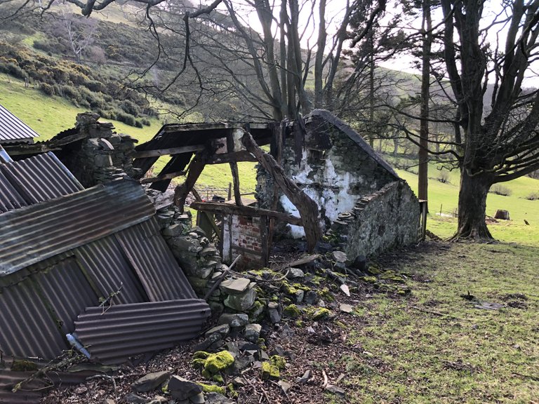
We passed some super old, dilapidated farm buildings and took guesses at how old they were, admiring the ancient looking oak timbers, now visible thanks to a missing roof.
Penycloddiau
Less than an hour in, we found ourselves approaching our first hill. Penycloddiau (Pen-ih-cloth-ee-eye) is one of three hills on the range that have the remains of Iron Age hill forts at the top. During excavations, where a number of 4000 year old tools were found, there was also evidence to show the site was previously used in the Bronze Age as a place of burial.
.JPG)
The summit is marked by a large cairn that has been reconstructed to accurately resemble the original burial mound.
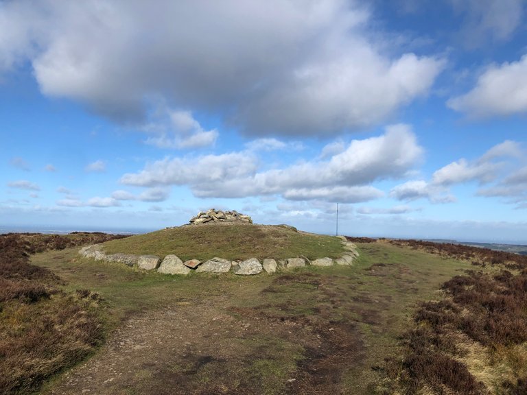
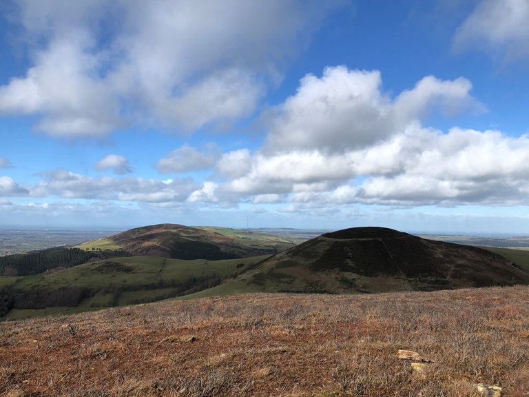
Penycloddiau summit cairn and BBC radio mast in the distance
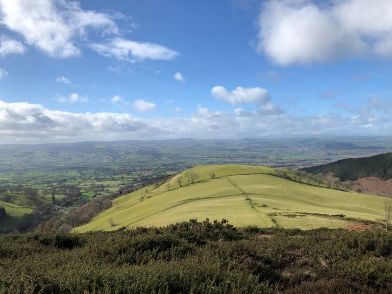
Standing on the raised Iron Age fort ramparts that circle the summit of the hill, an inviting perspective of the route ahead develops. Thanks to storm Jorge, who was blowing like crazy up here, the sky was kept blue as we descended our first peak of the range and on to the next one.
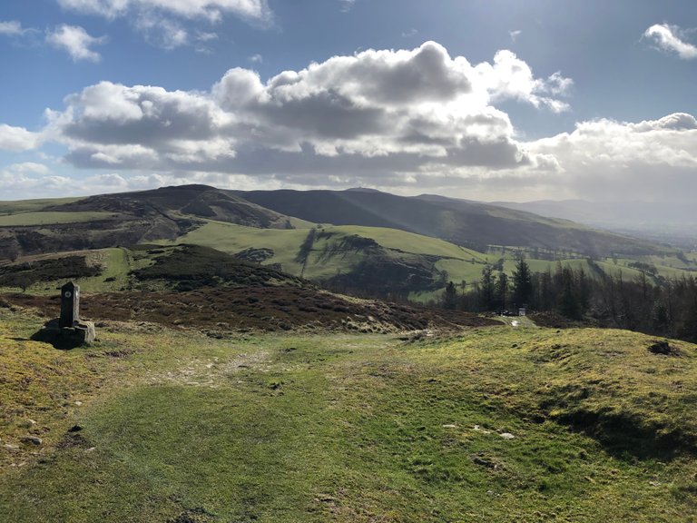
Iron Age ramparts and flooding in the vale of Clwyd after recent heavy rainfall
Moel Arthur
Only a mile down the trail our ascent to Moel Arthur began. Again, this hill was once used as a fort thousands of years ago and it was obvious to why as we struggled up its slopes.
Any would-be attacker wouldn't have had the luxury of steps to get them out of this defensive ditch
Anyone living up here in ancient times would feel extremely safe, protected by the equally steep slopes all around. The fort would have had a large wooden fence perimeter with watch towers and protected further by the ramparts mentioned earlier.
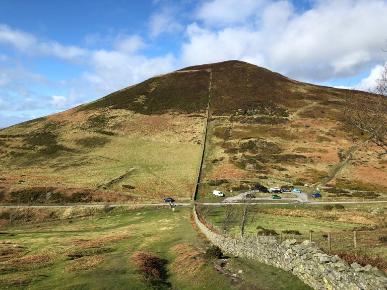
Moel Arthur viewed from the south-east - Notice the hill fort boundary near the top. Evidence of mining can be seen above the car park also
The roundhouses that people lived in, inside the walls were made from wood and cladded with wet manure and earth, a thatch roof and central fire pit. They were surprisingly warm and spacious.
Excavations in 1962 unearthed copper axe heads from the Bronze age and Roman pottery, proving this hill was an attractive location throughout the ages.
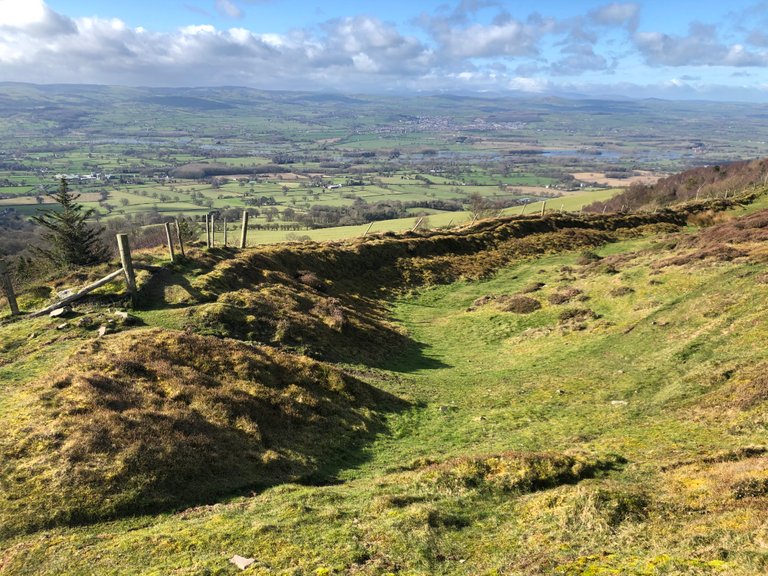
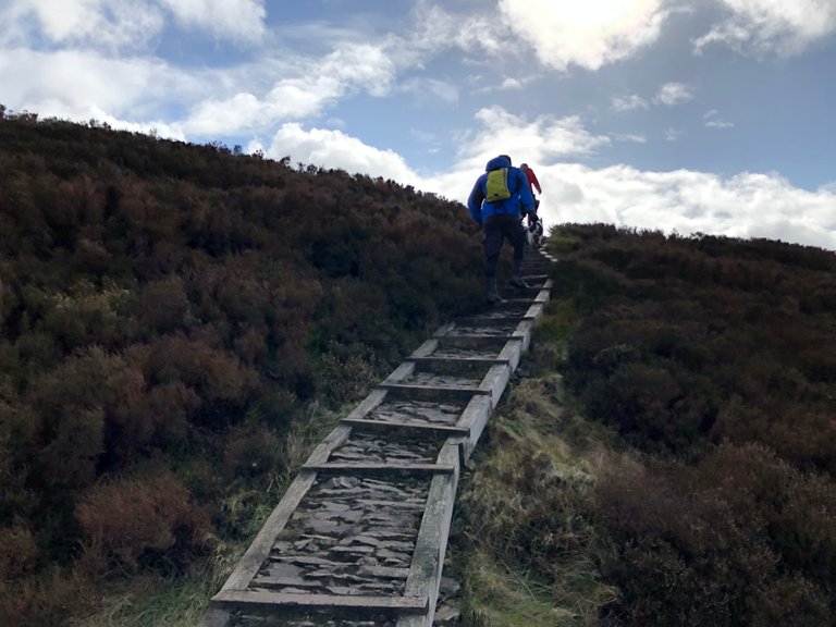
After a quick break from the wind in the car park, we ascended again towards our last peak of the day and the biggest of the Clwydian range, Moel Famau. It would be a long gradual hike from here as we looked back to where we started.
The wind had really picked up now as we walked the tops. I reached for my buff and wrapped it around my ears and over the top of my cap to keep it from blowing away.
We took a short detour away from the path in order to bag a smaller peak, Moel Dywyll. For a small lump, it flaunted the biggest cairn of the day in the form of a pile of big stones that looked almost like a well as we got closer.
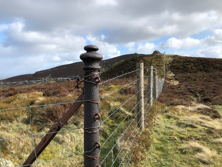
A Victoian fence post flanked by Moel Dywyll and Moel Famau
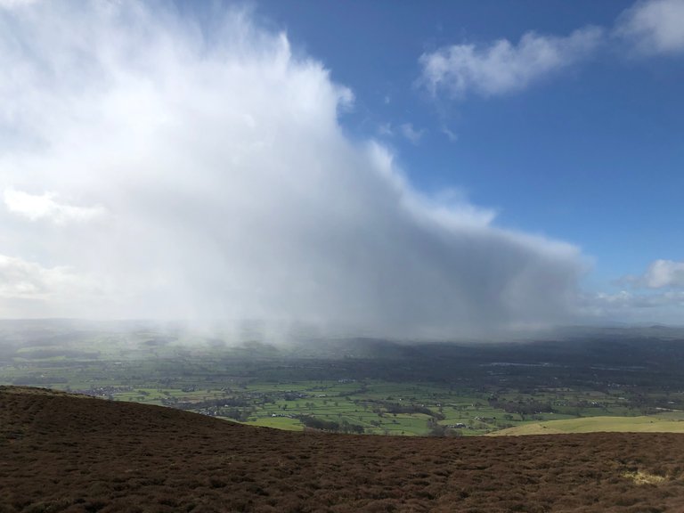
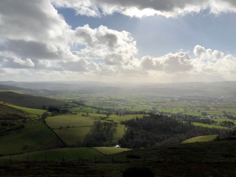
We'd been quite lucky with the weather so far today. Although it was gusty the sun had been beating down on the trails and it was pleasant. However, Jorge had one last trick up his sleeve and from the south appeared a huge wall of hail and rain. We could see it in the vale in front of us, eating up villages and fields as it swiped across the landscape.
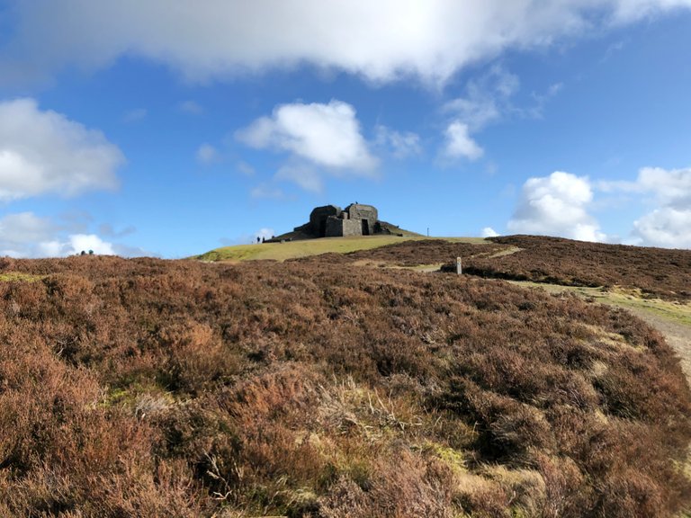
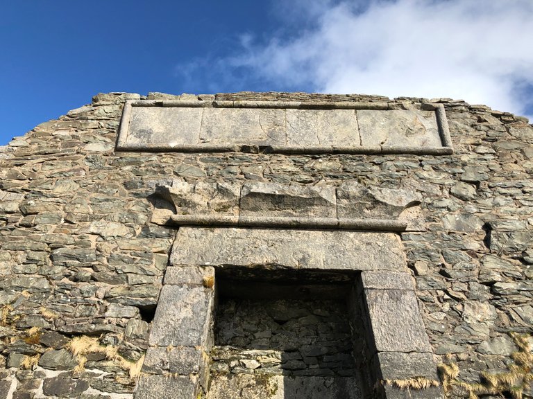
Moel Famau is marked by the remains of a huge obelisk type structure, known as the jubilee tower.
I wrote a short piece a while back about some interesting graffiti that can be found on the walls of the tower and a little background information into its history and purpose. Take a look here:
https://steemit.com/photography/@x-53degreesnorth/hidden-victorian-graffiti
As we neared the summit of the popular weekend hiking destination, families and dog walkers littered the tower as they took shelter from the biting wind in its huge arches.
It's usually nice to fire up a brew here and savour the moment of being the highest person in North East Wales, but today, after a quick look at the Victorian graffiti and pointing them out to some passing families, we exited the summit sharply down the main path, which now had a steady stream of weekend wanderers heading to the summit.
Other than a short blast of hail that stung the tops of my ears, we came out of the approaching weather front unscathed and arrived at the finish with bone dry clothes albeit a bit chilly.
The sun now sat behind some fluffy clouds and projected an unusual light-show onto the hillside below us, The long shadows of the trees extending out in the afternoon light, adding some interesting depth to the landscape. A fitting vista to end another successful hike.
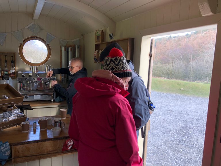
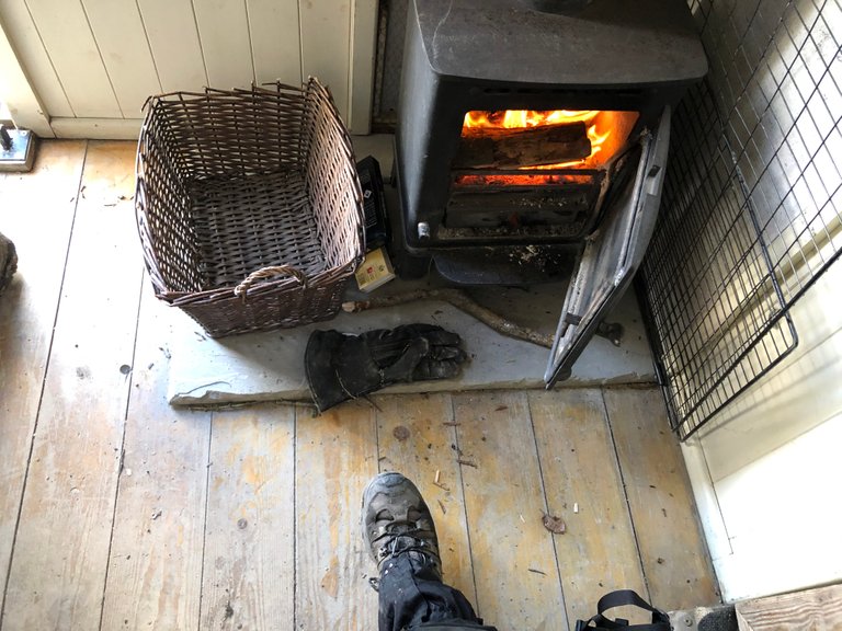
There is a little hut on the car park which sells hot drinks and snacks. Lured in by the heat of the log burner we snuggled in for a hot coffee and some flapjacks and chatted to friendly hut owner who had also made a start to the Offa's Dyke Path himself. We compared notes, dragging the conversation out to enjoy the warmth after eventually supping up and making way for some equally frozen walkers waiting outside.
Leg two complete and the next leg is penciled in for Wednesday. Have a great weekend and thanks for reading!
@tipu curate
Upvoted 👌 (Mana: 20/25 - need recharge?)
Congratulations @x-53degreesnorth! Your post made the TravelFeed team happy so we have sent you our big smile. Keep up the good job. 😃
We noticed that you did not publish your post through TravelFeed.io or edited your post on other Steem frontends. For better-looking blogs, we recommend you use our EasyEditor. As a bonus, when you post through our platform, you receive double upvotes from us, you are eligible for the top pick of the day (resteem + featured on the TravelFeed.io front page) and you can earn extra rewards from being featured in our daily curation posts. You can simply log in with your existing Steem account using Steemconnect or Steem Keychain. See you next time on TravelFeed.io!
Thanks for using TravelFeed!
@elsaenroute (TravelFeed team)
PS: TravelFeed is in social media to reach out more people, follow us on Facebook, Instagram, and Twitter.