We're Gonna Pass - Colorado Pass #3 - Coal Bank Pass
Moving to Colorado, we found something new to collect: passes. These are places that a road or hiking path was created at the lowest point between two mountains. You will find 166 mountain passes over 7,783 feet (2,372 m). Of those passes, 107 are actually drivable; however, there are only 61 of those are paved while the rest are either gravel or unimproved. Of the 61 roads that are drivable with an ordinary car (meaning low clearance and not a 4×4), 30 of them are over 10,000 ft (3048 m). Stat wise, this is a very collectible project.
If you would like to learn about what a pass is and how Colorado keeps travelers safe, please read our post We're Gonna Pass, Thank You - Colorado Passes and How To Traverse Them.
To view the article for the first Colorado Pass we visited, Kenosha Pass, CLICK HERE
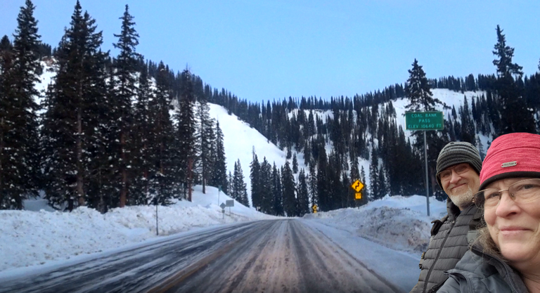
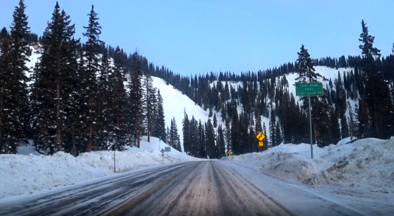
This is a composit from our video screenshot & one of our selfies.
We were unable to stop and get a sign selfie.
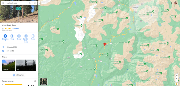
Screenshot of Coal Bank Pass' location from Google Maps.
To view the article for the second Colorado Pass we visited, Wolf Creek Pass, CLICK HERE
This is a composit from our video screenshot & one of our selfies.
We were unable to stop and get a sign selfie.
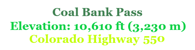
Coal Bank Pass is 10,610 ft (3,234 m) located on Colorado Highway 550, just 34 miles north of Durango near Purgatory Resort it is a steady climb up. Even though it is not on the "Million Dollar Highway," it still has the same feeling as you drive close to the mountains' edges. Weather pending, almost all types of passenger vehicles can make it to the top where hikers can find the Engineer Mountain Trailhead. The town of Silverton is only 14 miles north of this pass, which is also the County Seat of San Juan County.
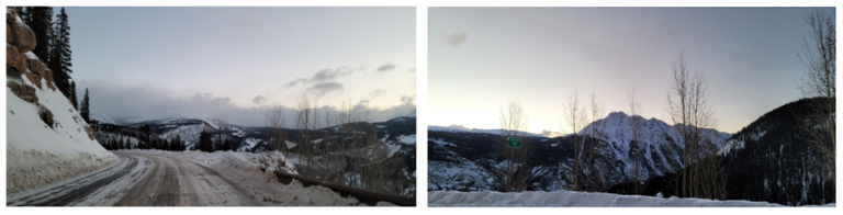
This was the very first pass we ever crossed that had a snow/ice-covered road. From just below the pass until we made it to Ouray (at the north end of the Million Dollar Highway) we questioned ourselves on if we should have put on chains. Looking back at the videos and images, we question our sanity, because we so should have put on the chains!
[//]:# (!pinmapple 37.700629 lat -107.777033 long d3scr)
Thank you so much for taking the time to read our blog posts.
We appreciate it so very, very much!


* My posts may occasionally contain affiliated work-related links because our Cross County Travels website
and our YouTube channel are also our accounts.
* The photographs on our posts are taken with my own camera
and with Scott's help!
* Blog graphics such as various "flyers" will be cited at each occurrence.
* Clipart used are from https://www.cleanpng.com/
and/or https://pixabay.com/.
* While the Bitmoji Characters of Scott & Ren are from Bitmoji,
the compilations are my own.
* All words and images are mine (unless otherwise indicated),
and can also be found on my various social media accounts: OUR FACEBOOK
OUR INSTAGRAM
OUR TWITTER
OUR WEBSITE
cross mentions are spreading the word.


We appreciate it so very, very much!
and our YouTube channel are also our accounts.
and with Scott's help!
and/or https://pixabay.com/.
the compilations are my own.
and can also be found on my various social media accounts:
OUR TWITTER
OUR WEBSITE
cross mentions are spreading the word.
haveyoubeenhere
pinmapple
mountains
travel
colorado
ladiesofhive
thealliance
palnet
amazingnature
theterminal
0
0
0.000
Geographically so different to our part of the world, love high passes where you get a great view, Driving them is part of the adventure obviously we don't have ice or snow often, have no idea how to drive on it!
To be honest, neither did we! This was part of the trip we drove thinking the roads would be clear. We argued over whether to put chains on or not then tried to decide if we were going to turn around. It was one of the most beautiful drives we have ever been on and I would do it again in a heartbeat!
Glad you didn't turn around, sometimes going into a drive not knowing the conditions can turn into a lot of good fun and excellent scenery.
Your content has been voted as a part of Encouragement program. Keep up the good work!
Use Ecency daily to boost your growth on platform!
Support Ecency
Vote for Proposal
Delegate HP and earn more
Congratulations, your post has been added to Pinmapple! 🎉🥳🍍
Did you know you have your own profile map?
And every post has their own map too!
Want to have your post on the map too?
This seems like a great trailing track, but not an easy one considering the winter conditions.
To be honest, if we would have known what we were doing, we would have not driven it. However, I am so glad we did. Fortunately for us, the conditions were better than they usually are in the winter there!.