Safe level - Cota segura
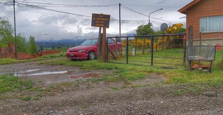
A couple of days ago, going to the lot located in the Altos de Trevelin, where preparations are being made for the construction of the house for my son and his family, I saw and photographed the accompanying photograph that gives rise to this publication.
In a high area but relatively close to the center of town, a sign located clearly visible on the curve of the road and attached to an old house guarded by a somewhat dilapidated vehicle read: “You. it is at a safe level ”. It immediately caught my eye and I stopped to take this picture.
The question that immediately arose to me was: why was this sign that indicates that in that place it is safe from a flood was placed there? We are not close to the sea and although it is a mountainous area and therefore more prone to earthquakes, it is totally impossible that the water from a tsunami could devastate that area, well unless it was a world cataclysm in the style of the 2012 movie. But that is fantasy or not?
A few minutes after observing the sign, I arrived at the lot and there the professionals in charge of leveling the land and building the anti-seismic stalls were waiting for me, on which the construction of the house will then begin, I questioned them about the sign and they did not know the answer to my previous question.
So, somewhat restless for not having an answer that would appease my desire to know, I returned to the center of Trevelin after finishing my tasks and as I passed the fire station it occurred to me to stop to ask, maybe they could solve the mystery.
I was received by the captain of the distribution and after my explanation, he answered perfectly my simple question, near, although not so much from the town, a dam was built in the 1970s that reservoirs the Futaleufú or Grande river, originally its electricity production was It is intended to supply electricity to the Aluar industrial plant, the most important aluminum factory in Argentina. Over the years, the distribution of the surplus to the surrounding towns and cities was enabled. The dam lake is so large and imposing that if an accident occurred that broke the retaining wall, the water could reach the town of Trevelin and that sign indicates that there would be no problems with the flood that it would generate.
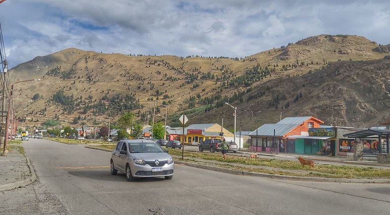
Luckily my son's lot is even higher than that place, the biggest problem is that 85% of the town is below it.

Un par de días atrás, yendo hacia el lote ubicado en los Altos de Trevelin, donde se están haciendo los preparativos para la construcción de la vivienda de mi hijo y su familia, vi y retraté la fotografía que acompaña y que da origen a esta publicación.
En una zona alta per relativamente cerca del centro del pueblo un cartel ubicado bien visible en la curva del camino y pegado a una casa de antigua construcción custodiada por un vehículo un tanto destartalado rezaba: “Ud. se encuentra en cota segura”. Inmediatamente llamó mi atención y me detuve a tomar esta fotografía.
La pregunta que me surgió inmediatamente fue: ¿por qué este cartel que indica que en ese lugar se está a resguardo de una inundación estaba puesto allí? No estamos cerca del mar y aunque es zona montañosa y por ende más propensa a terremotos es totalmente imposible que el agua de un tsunami pudiera arrasar esa zona, bien a menos que fuera un cataclismo mundial al estilo de la película 2012. Pero eso es fantasía ¿o no?
Unos minutos después de haber observado el cartel llegué hasta el lote y allí estaban aguardándome los profesionales a cargo de la nivelación del terreno y de la construcción de la platea antisísmica sobre la que luego comenzará la construcción de la casa, los interrogué sobre el cartel y no sabían la respuesta a mi pregunta anterior.
Así que un tanto inquieto por no tener una respuesta que aplacara mis ansias por saber, volví al centro de Trevelin luego de finalizada mis tareas y al pasar por el cuartel de bomberos se me ocurrió parar para preguntar, quizás ellos pudieran resolver el misterio.
Fui recibido por el capitán de la repartición y luego de mi explicación respondió perfectamente a mi sencilla pregunta, cerca, aunque no tanto del pueblo, se construyó en los años 1970, una represa que embalsa el río Futaleufú o Grande, originalmente su producción eléctrica estaba destina a abastecer de electricidad a la planta industrial de Aluar, la fabrica de aluminio más importante de la Argentina, con el correr de los años se habilitó la distribución del excedente a los pueblos y ciudades aledañas. El lago de la represa es tan grande e imponente que si ocurriera un accidente que rompiera el muro de contención, el agua podría llegar al pueblo de Trevelin y ese cartel indica que a partir de allí no habría problemas con la inundación que la misma generaría.
Por suerte el lote de mi hijo esta más arriba aun de ese lugar, el mayor problema es que el 85% del pueblo está por debajo de la misma.
Las fotografías son de mi propiedad excepto las que menciono la fuente.
The photographs are my property except those mentioned by the source.
Héctor Gugliermo
@hosgug