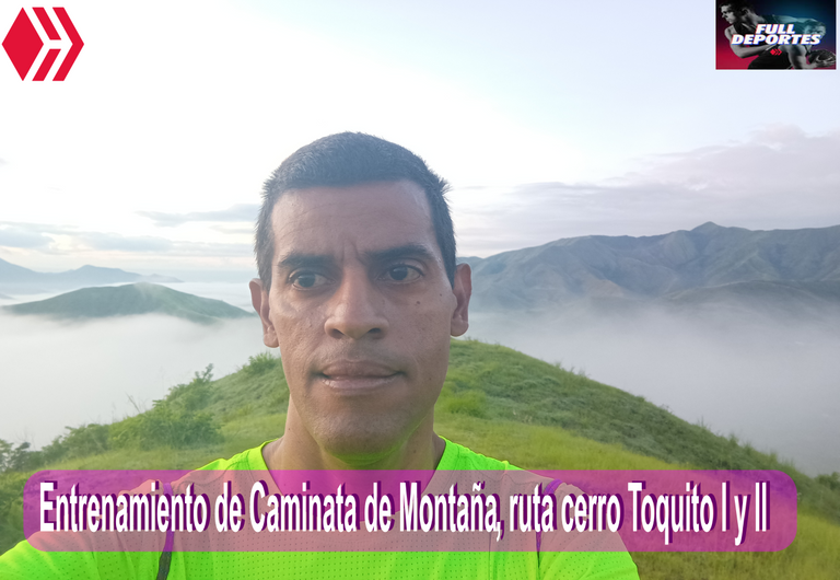
Entrenamiento de Caminata de Montaña, ruta cerro Toquito I y II [ESP/ENG]
Greetings friends of Hive and @fulldeportes, today I'm going to share my mountain hiking training in El Toquito I and II hill in the community of Villa de Cura, Aragua state, Venezuela.
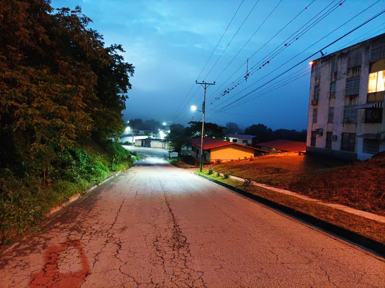
Para este entrenamiento, me levante 5:20 am, para estar listo y salir a las 5:40 am, pude observar una gran cantidad de neblina y un poco de frio en la comunidad, debido a que llovió anoche, en esta oportunidad no me traje a mi mascota, porque tiene una lesión en una de las patas, debido a que otro perro lo mordió cuando estaba en la calle. En este entrenamiento active la aplicación Strava y Actitif para llevar el registro de esta ruta.
For this training, I got up at 5:20 a.m., to be ready and leave at 5:40 a.m., I was able to observe a lot of fog and a little cold in the community, because it rained last night, this time I did not bring my pet, because it has an injury to one of its legs, due to another dog biting it when it was on the street. In this training, activate the Strava and Actitif application to keep track of this route.
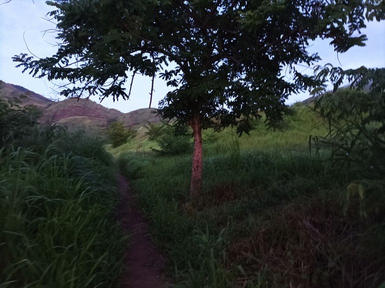
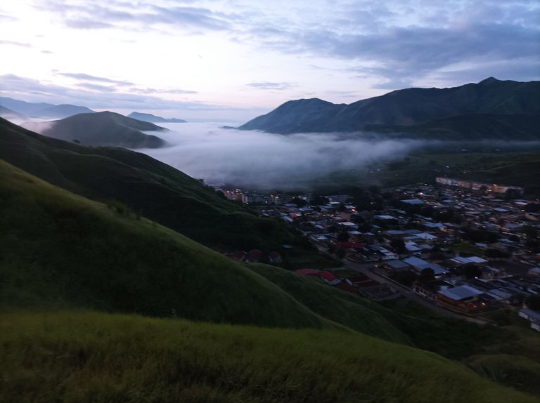
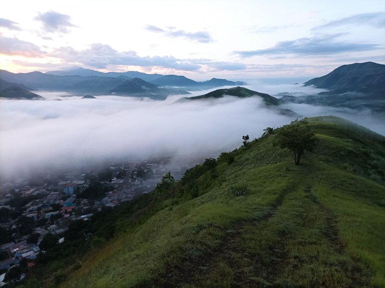
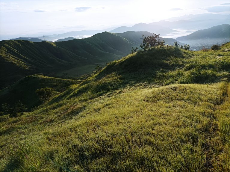
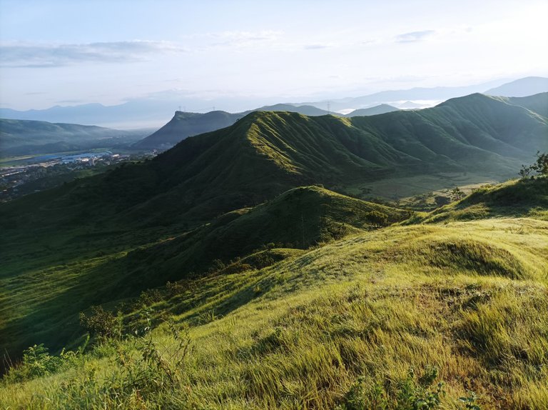
Cabe destacar que camine a un ritmo constante, no había decidido si iba a realizar la ruta de Malpica El Toro, o el cerro El Toquito, porque es la misma vía, subiendo por la calle Doctor Morales y me desvío a manos derecha para llegar al sector de El Toquito, registrando ya finalizando esta parte de la comunidad con un tiempo de 19 minutos. Después comencé a subir la primera loma, que es bastante empinada, desde esta altura se puede ver como la neblina cubre parte de la localidad, es muy agradable disfrutar de esta belleza natural, estas son las cosas que me gustan cuando salgo a entrenar a la montaña.
It should be noted that I walked at a constant pace, I had not decided if I was going to take the Malpica El Toro route, or the El Toquito hill, because it is the same route, going up Doctor Morales street and I deviated to the right to reach the El Toquito sector, registering the end of this part of the community with a time of 19 minutes. Then I started to climb the first hill, which is quite steep, from this height you can see how the mist covers part of the town, it is very nice to enjoy this natural beauty, these are the things I like when I go training in the mountains.
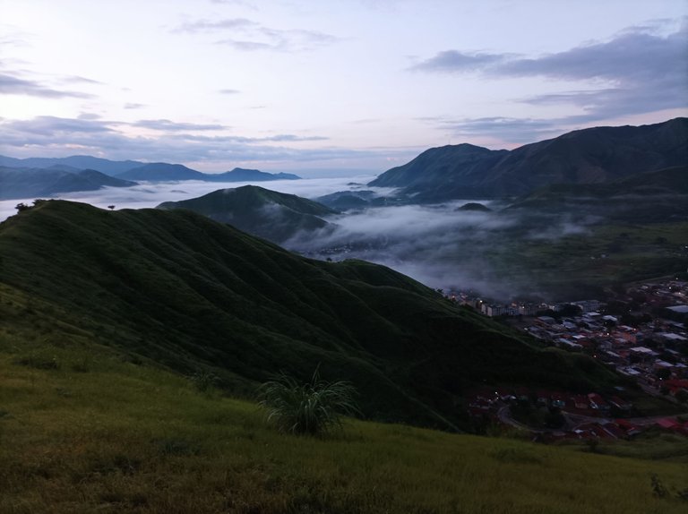
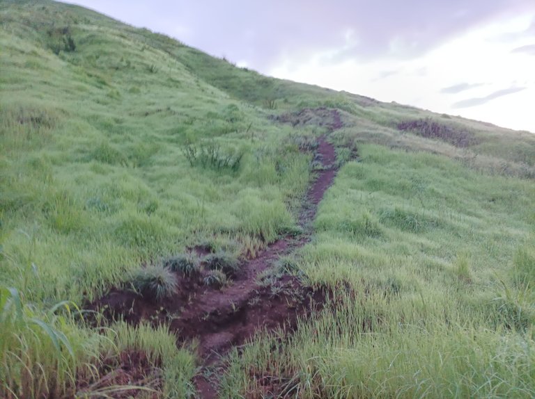
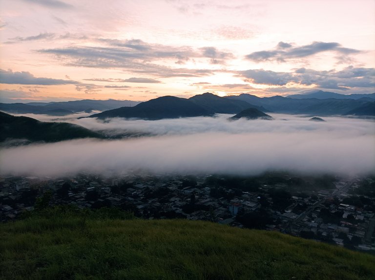
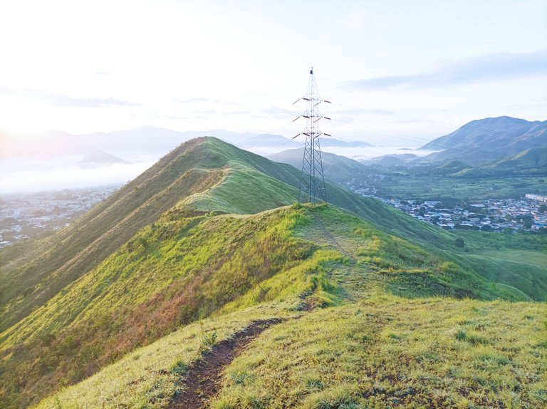
Después de pasar la primera subida, seguidamente viene la otra pendiente, mi reloj marco un tiempo de 24 minutos, me detuve unos segundos para tomar algunas fotografías de la belleza natural de esta montaña, luego viene la tercera montaña para llegar a la cima, con un registro de 31 minutos, me desvié a mano derecho de la montaña para aprovechar y captura algunas fotografías, desde la altura podemos ver parte de la comunidad de Villa de Cura, cubierta de Neblina.
After passing the first climb, then the other slope comes, my watch marked a time of 24 minutes, I stopped for a few seconds to take some photographs of the natural beauty of this mountain, then comes the third mountain to reach the top, with a record of 31 minutes, I turned to the right of the mountain to take advantage and capture some photographs, from the height we can see part of the community of Villa de Cura, covered in Fog.
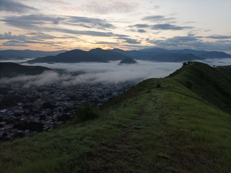
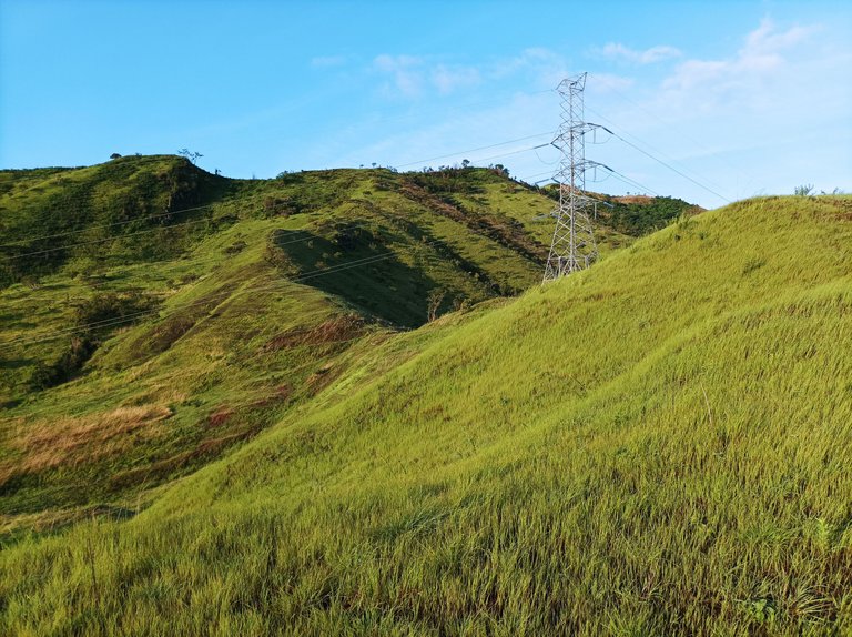
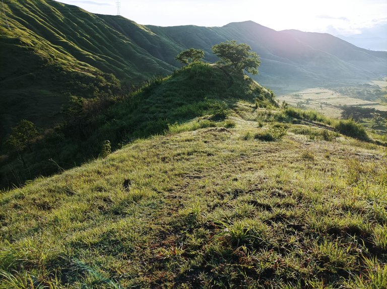
Una vez que termine de tomar las fotografías, me hidrate un poco, y luego comencé a bajar por la parte done están la torre eléctrica y salir por detrás de la pista de atletismo, en este recorrido los zapatos se mojaron totalmente porque los arbusto estaban llenos de agua, debido a la lluvia, esto para no fue impedimento para hacer esta ruta, al terminar de bajar ya mi reloj registraba un tiempo de 1 horas.
Once I finished taking the pictures, I hydrated myself a bit, and then I began to go down the part where the electrical tower is and exit behind the athletics track. On this route, my shoes got completely wet because the bushes were full of water, due to the rain, this was not an impediment to doing this route, when I finished going down my watch registered a time of 1 hour.
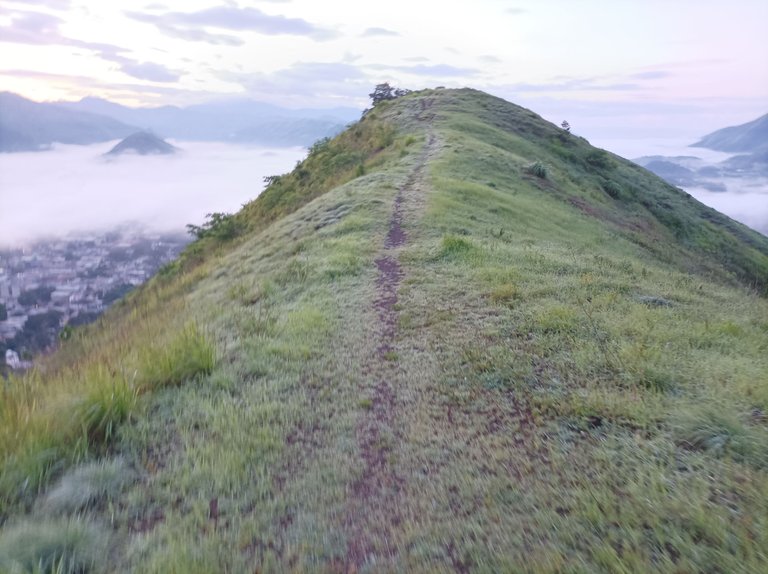
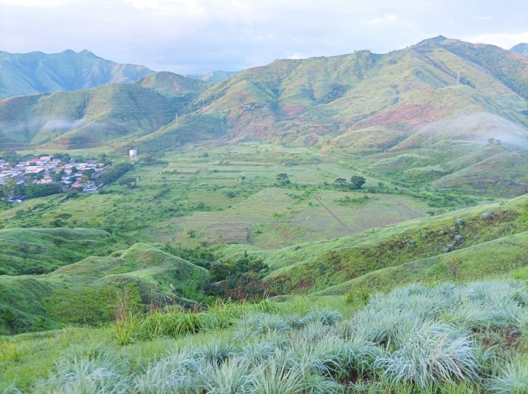
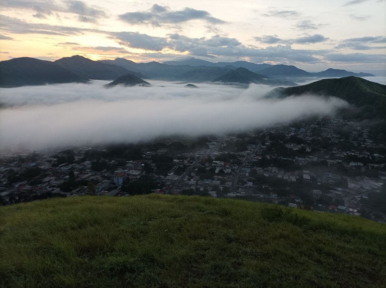
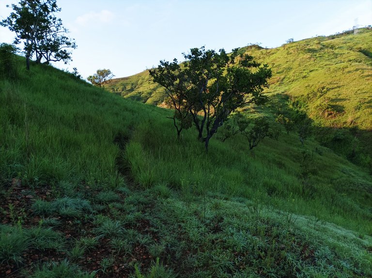
Ahora bien, al llegar a esta parte plana, comencé a subir la montaña que se encuentra al frente de la pista, para hacer más kilometraje, continué subiendo en el cerro El Toquito II, me sentía cómodo con este entrenamiento, y subí dos pendientes, faltaba poco para llegar a la cima de esta montaña, pero entonces decidí retornar para volver a mi casa. A partir de aquí, lo que viene es pura bajada, que sirve de descanso después del esfuerzo en las pendientes de la montaña.
Now, when I reached this flat part, I began to climb the mountain that is in front of the track, to do more mileage, I continued climbing El Toquito II hill, I felt comfortable with this training, and I climbed two slopes, it was not long before I reached the top of this mountain, but then I decided to return to return home. From here, what comes is a pure descent, which serves as a rest after the effort on the mountain slopes.
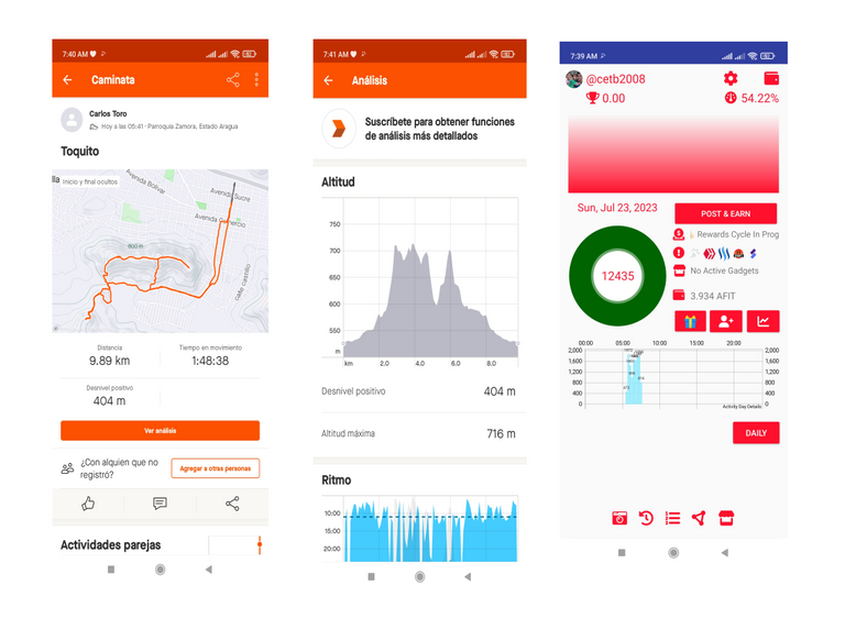
Al llegar a la pista, pude ver a una pareja que estaba entrenando, los días domingos son muy pocas las personas que se ven haciendo ejercicios, porque generalmente lo hacen los días de semanas, mi reloj marco 1 hora con 30 minutos, me quedaba el trayecto para pasar por la urbanización y llegar al centro de la comunidad, para luego llegar a la casa con un tiempo de 1 hora con 55 minutos, con un kilometraje de 9 km y 890 metros en la aplicación Strava, y 12435 pasos en la aplicación Actitifit.
When I got to the track, I could see a couple who was training, on Sundays there are very few people who can be seen exercising, because they generally do it on weekdays, my watch marked 1 hour and 30 minutes, I had the journey left to go through the urbanization and get to the center of the community, to then arrive home with a time of 1 hour and 55 minutes, with a mileage of 9 km and 890 meters in the Strava application, and 12435 steps in the A application Actifit.
Espero que les haya gustado este entrenamiento, nos vemos en el próximo.
I hope you liked this training, see you in the next one.
Fotografías: Teléfono Redmi Note 10
Portada realizada en Inkscape
Logos utilizados de Hive y de @fulldeportes
Traductor utilizado: https://www.deepl.com/
Photos: Redmi Note 10 Phone
Cover made in inkscape
Logos used from Hive and @fulldeportes
Translator used: https://www.deepl.com/

Vote la-colmena for witness By @ylich

https://leofinance.io/threads/cetb2008/re-leothreads-2xzocel73
The rewards earned on this comment will go directly to the people ( cetb2008 ) sharing the post on LeoThreads,LikeTu,dBuzz.
@cetb2008
https://leofinance.io/threads/view/fulldeportes1/re-leothreads-tv4ebke5
Hola @cetb2008 me gustó esta caminata, sobre todo el clima de montaña y todas las hermosas imágenes que nos regalaste.
Excelente como siempre 💪💪
Hola que bueno amiga, muchas gracias.
Hay un dicho que reza"Al que madruga Dios lo ayuda" aplica en tu caso pero también: Al que madruga la naturaleza lo sorprende con esta belleza, lo que muestran estas fotos es demasiado hermoso, un conjunto de elementos que extasían la vista, gracias por madrugar para mostrar estos paisajes y entrenar, te felicito...un fuerte abrazo!
Hola, gracia,si me gusta levantarme temprano para salir a entrenar y disfrutar de la belleza natural, muchas gracias por tu comentario.
El clima se ve espectacular mi pana, tremendo paisaje 👏👏👏😃
Saludos amigo,si un clima agradable, gracias por tu comentario